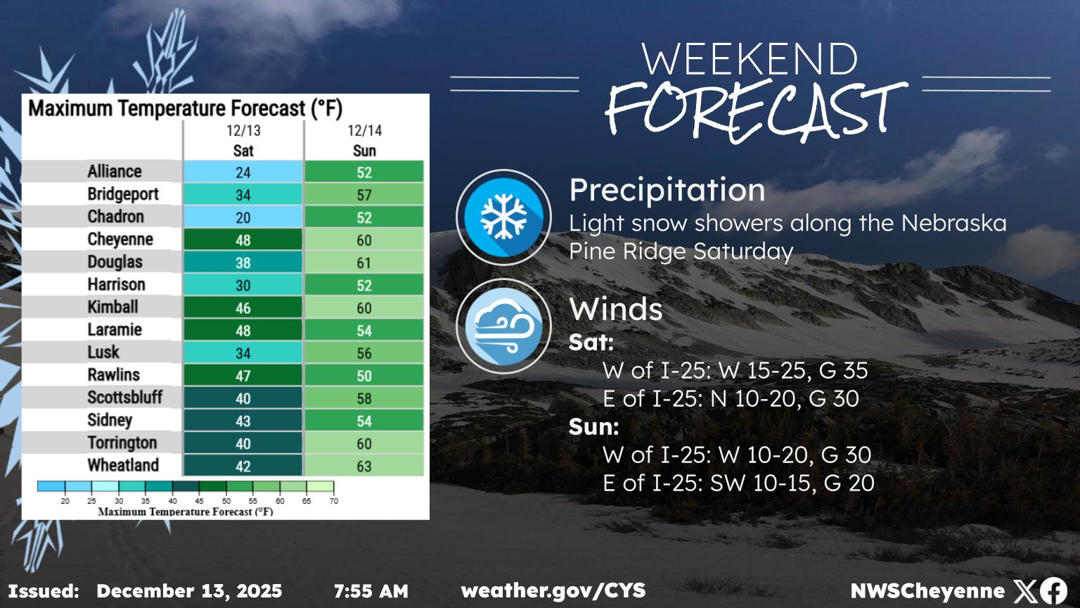
UPDATE: Severe Thunderstorm Watch Issued For Southeast Wyoming
UPDATE: At 1p.m. the Cheyenne Office of the National Weather Service issued a severe thunderstorm watch for southeast Wyoming, including Laramie County.
A Severe T'Storm Watch is in effect for portions of southeast Wyo and the Neb panhandle through this evening. The primary concern is very large hail, although the stronger storms will also be capable of a tornado or damaging winds

The agency also issued an updated map for possible weather hazard around 12 noon:

Original Post: The Cheyenne Office of the National Weather Service is warning about possible sever storms in southeast Wyoming this afternoon and evening [June 1].
As of Monday morning, Laramie was just outside of the warning area for large hail and strong winds, but Cheyenne was included in areas covered by those warnings. The agency says tornadoes are also possible in extreme southeast Wyoming, but the area covered by that hazard did not include either Cheyenne or Laramie.
The agency posted the following on its website:
There is a Slight Risk (Level 2 of 5) for severe weather across far southeastern Wyoming and western Nebraska for Monday. All modes of severe weather are possible: hail (up to 2 inches), damaging wind gusts, and an isolated tornado or two. The strongest storms are expected between 3 and 9 PM, with storms starting in southeast Wyoming and moving east into the Nebraska Panhandle. Stay weather aware on Monday and have multiple ways to receive warnings!
Here are the maps showing other possible hazards

Cheyenne, Laramie Forecasts
Cheyenne Forecast
Laramie Forecast
The Hidden Treasures Of Wyoming's Natural Bridge
Gallery Credit: Glenn Woods
More From KGAB