The Cheyenne Office of the National Weather Service says southeast Wyoming can expect record heat today [July 26, 2026].

The agency posted the following on its website:

"The heat wave will reach its peak on Sunday, with another round of record breaking high temperatures expected across the area. Most locations have approximately a 10% chance to tie the all-time hottest temperature recorded today. In addition, another round of widely scattered high-based showers and thunderstorms is expected this afternoon and evening. Coverage will be a little less compared to yesterday, but storms will still have the potential to produce lightning and gusty/erratic winds. Be weather aware if you have outdoor plans today! Note: Due to a decrease in the forecast high temperatures for Monday, the Heat Advisory and Extreme Heat Warning will now expire at 9PM today. "
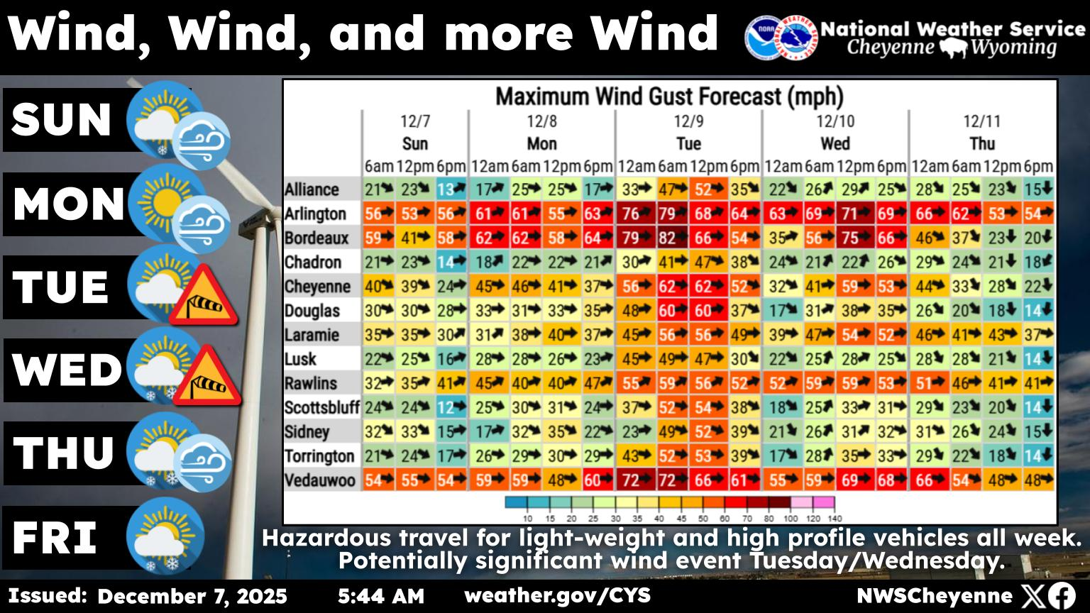

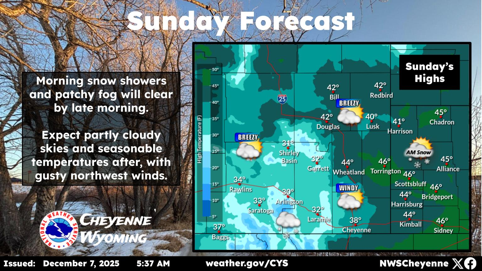
Another very hot day is expected Sunday across the area. Heat Advisories and Extreme Heat Warnings remain in effect until 9PM this evening. Look for high temperatures similar to Saturday, reaching the low to mid 90s in Rawlins, Laramie, and Saratoga, upper 90s in Cheyenne, and 100s for remaining areas of the High Plains. Note: Due to an acceleration in the arrival of monsoon moisture on Monday, forecast high temperatures have decreased slightly. Therefore, the Heat Advisory and Extreme Heat Warning will now expire at 9PM today.

Cheyenne, Laramie Forecasts

Cheyenne Forecast

Today
A 30 percent chance of showers and thunderstorms after 3pm. Mostly sunny and hot, with a high near 97. North northwest wind 10 to 15 mph.
Tonight
A chance of showers and thunderstorms before 9pm, then a slight chance of showers between 9pm and 3am. Mostly cloudy, with a low around 65. Northwest wind 5 to 10 mph. Chance of precipitation is 30%.
Monday
A slight chance of showers, then a chance of showers and thunderstorms after noon. Partly sunny and hot, with a high near 90. Northwest wind 5 to 10 mph becoming east southeast in the afternoon. Chance of precipitation is 50%.
Monday Night
A chance of showers and thunderstorms. Mostly cloudy, with a low around 60. Southeast wind 5 to 10 mph becoming west northwest after midnight. Chance of precipitation is 50%.
Tuesday
A 50 percent chance of showers and thunderstorms after noon. Mostly sunny, with a high near 88. West northwest wind 5 to 10 mph becoming east in the afternoon.
Tuesday Night
A 40 percent chance of showers and thunderstorms before midnight. Partly cloudy, with a low around 57.
Wednesday
A 50 percent chance of showers and thunderstorms after noon. Mostly sunny, with a high near 88.
Wednesday Night
A chance of showers and thunderstorms before midnight. Mostly cloudy, with a low around 58.
Thursday
A slight chance of showers and thunderstorms after noon. Sunny and hot, with a high near 90.
Thursday Night
Partly cloudy, with a low around 58.
Friday
A slight chance of showers and thunderstorms. Sunny, with a high near 89.
Friday Night
A slight chance of showers and thunderstorms. Mostly clear, with a low around 57.
Saturday
Sunny and hot, with a high near 90.

Laramie Forecast

Today
A 50 percent chance of showers and thunderstorms, mainly after 3pm. Mostly sunny, with a high near 87. Northwest wind 5 to 10 mph.
Tonight
A chance of showers and thunderstorms before 9pm, then a slight chance of showers between 9pm and 3am. Mostly cloudy, with a low around 63. West wind around 5 mph becoming south southwest in the evening. Chance of precipitation is 30%.
Monday
A slight chance of showers, then showers likely and possibly a thunderstorm after noon. Cloudy, then gradually becoming mostly sunny, with a high near 81. Southwest wind 5 to 10 mph becoming northeast in the afternoon. Chance of precipitation is 60%.
Monday Night
A chance of showers and thunderstorms before 9pm, then a chance of showers between 9pm and midnight. Mostly cloudy, with a low around 62. Southwest wind 5 to 10 mph. Chance of precipitation is 50%.
Tuesday
Showers likely and possibly a thunderstorm between noon and 3pm, then showers and thunderstorms likely after 3pm. Mostly sunny, with a high near 80. Southwest wind around 5 mph becoming north northeast in the afternoon. Chance of precipitation is 70%.
Tuesday Night
A chance of showers and thunderstorms before 9pm, then a chance of showers between 9pm and midnight. Partly cloudy, with a low around 59. Chance of precipitation is 40%.
Wednesday
Showers and thunderstorms likely after noon. Mostly sunny, with a high near 79. Chance of precipitation is 70%.
Wednesday Night
A chance of showers and thunderstorms before midnight. Mostly cloudy, with a low around 59.
Thursday
A slight chance of showers and thunderstorms after noon. Sunny, with a high near 81.
Thursday Night
Partly cloudy, with a low around 59.
Friday
A chance of showers and thunderstorms. Sunny, with a high near 81.
Friday Night
Mostly clear, with a low around 59.
Saturday
Sunny, with a high near 83.

Old Cheyenne Buildings, New Purpose

Wyoming owner of TJoe's Restaurant and all-around entrepreneur Sherrie Lyle purchased some old buildings on the west side of downtown Cheyenne, Wyoming.

There is an opportunity to transform these once grand and now forgotten structures into a new business area.

Many new businesses are looking at this old side of Cheenne. Restaurants and stores are looking at the old structures and imagining what new things they can do with them.

Gallery Credit: Glenn Woods

More From KGAB