
UPDATE: High Wind Watch Area Expanded, Now Includes Laramie

UPDATE 4:15 P.M.: The Cheyenne Office of the National Weather Service has now expanded the area covered by the watch. Laramie, which was just outside the area covered by the original watch, is now included.
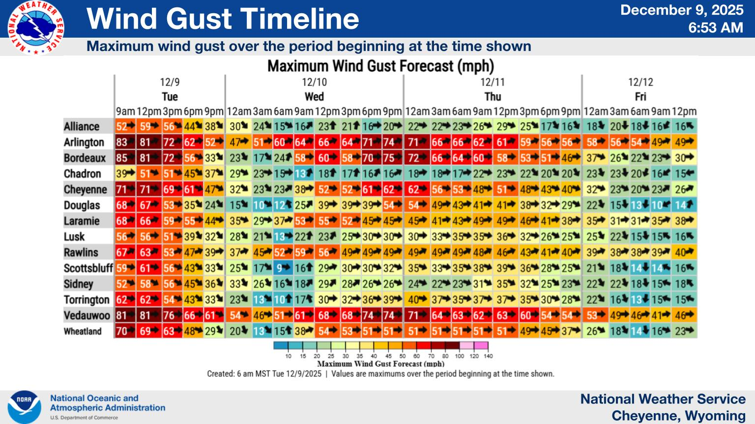
3:30 PM 4/21 - The High Wind Watch has been expanded to include much of southeast Wyoming and western Nebraska. Southwest winds will begin in Carbon County Wednesday morning, then spread east in the afternoon. A cold front Wednesday evening will shift the wind direction to the west or northwest for Wednesday night into Thursday. Gusts exceeding 80mph are possible in the typical wind prone areas, with gusts 55-70mph possible in the remaining locations. Use caution if traveling with lightweight or high profile vehicles.
Original Post: The Cheyenne Office of the National Weather Service has issued a High Wind Watch for areas of southeast Wyoming starting tomorrow.
The agency posted the following on it's Facebook page:
April 21st, 4:30 AM - A High Wind Watch has been issued for portions of Southeast Wyoming from late Wednesday morning through Thursday evening. Gusts exceeding 80mph are possible in the typical wind prone areas, especially the I-80 Summit and Bordeaux areas, with gusts 60-65mph possible in the remaining locations. Use caution if traveling with lightweight or high profile vehicles.

Cheyenne, Laramie Forecasts
Cheyenne Forecast
Penny's Diner At Bill Wyoming
Gallery Credit: Glenn Woods
More From KGAB


