Hail, 60+ MPH Winds, Isolated Tornadoes Possible In SE Wyoming UPDATED 1:15 P.M.

Unsplash [BOTH PHOTOS}[/caption]
UPDATE: At 1:15 p.m., the Cheyenne Office of the National Weather Service issued the following update

Original Post; The Cheyenne Office of the National Weather Service says severe storms are once again possible in southeast Wyoming today (June 20 as well as again on June 3 and 4 [Wed and Thursday]
The agency posted the following on its website
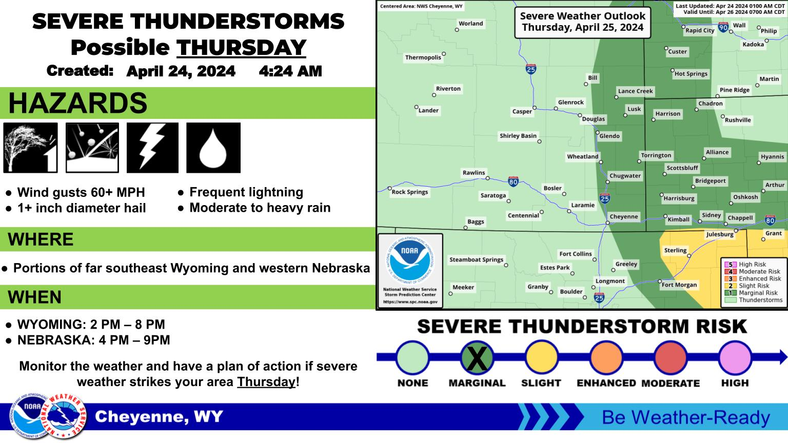
Another round of severe weather is in store for southeast Wyoming and western Nebraska on Tuesday. There is a Slight Risk (Level 2 of 5) for severe weather, with all modes of severe weather possible: hail (up to 2 inches), damaging winds (60+mph), flash flooding, and an isolated tornado or two. The strongest storms are possible between 2 and 8 PM. The highlighted region has the highest potential for isolated tornadoes. Be weather aware tomorrow and make sure to have multiple ways to get warnings!
More severe weather possible in some areas Wednesday and Thursday:
Cheyenne, Laramie Weather Forecasts
Cheyenne Forecast
Don't Let the Sunburn Keep You Down - Easy Remedies from the Mayo Clinic
Gallery Credit: JD Knight
More From KGAB


