SE Wyoming Weather: High Wind Watch Tuesday, Snow Possible Thursday
The Cheyenne Office of the National Weather Service is predicting warm temperatures the next couple of days, followed by the possibility of rain and/or snow Thursday.
That's according to the Cheyenne Office of the National Weather Service.
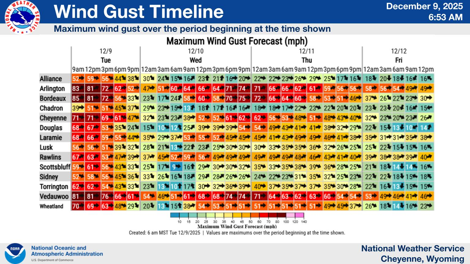
The agency says a High Wind Watch will take effect this evening [Dec. 29]:
"High Wind Watch in effect for a few wind prone areas of southeast Wyoming late Monday night through early Tuesday afternoon. Gusts up to 65 MPH and some blowing/drifting snow possible."
Otherwise, temperatures should be pretty mild the next couple of days, with changes possible later in the week.
Mild temperatures will return for the last few days of 2025 into early 2026. We won't be quite as warm as last week, nor as windy as the last several weeks, but look for temperatures largely in the 40s and 50s with breezy conditions Tuesday onwards. The next chance for some rain and snow showers will be with a disorganized potential storm system Thursday into Friday.
Forecasts For Cheyenne, Laramie
Cheyenne Forecast
Check Out the Damages from Cheyenne's Wild Spring Wind Storm
Gallery Credit: Doug Randall
More From KGAB