Golfball Size Hail and Tornadoes Possible Today In SE Wyoming
The Cheyenne Office of the National Weather Service is warning of severe thunderstorms, large hail, strong winds and possibly even a few tornadoes Friday afternoon and evening in southeast Wyoming and the Nebraska Panhandle.
The agency posted this statement on its website:
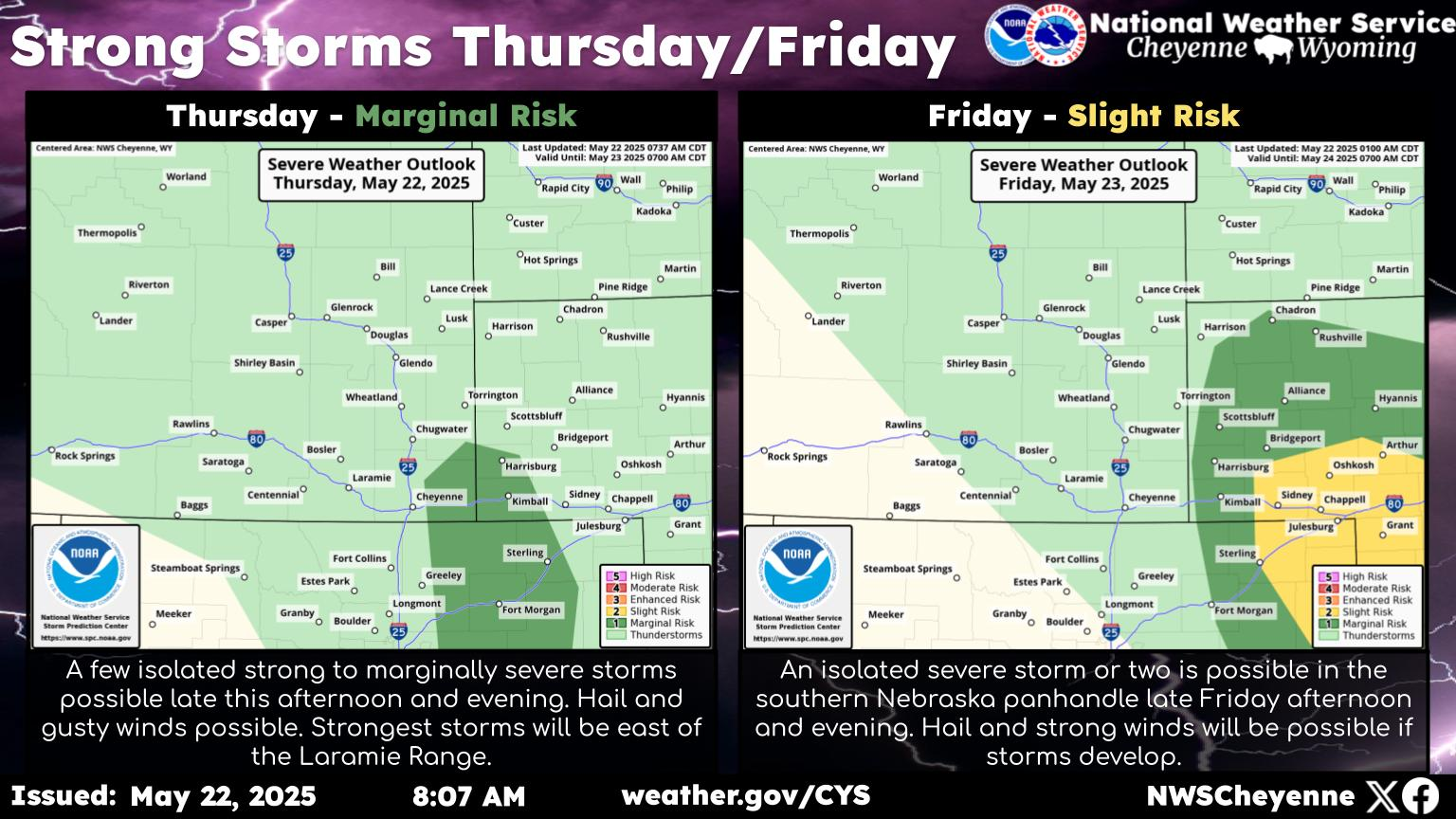
Update: Strong and Severe storms still look on track from 12pm-8pm across Wyoming High Plains and into the Nebraska Panhandle. Storms will start firing in a line around noon to 1pm near the Laramie Mountain Range and nearby High Plains of Wyoming. Cheyenne will be near the strongest of storms from 1pm through 4pm as they shift north & east. More isolated storms may develop 1-5pm in north Colorado & in the southern NE Panhandle with greater tornado potential (in the red zone). By mid- to late-afternoon, storms will move north & east into east Wyoming and NE Panhandle. Large Hail up to golfball, winds of 50 to 70 mph, and heavy rain will be the primary hazards through the early to mid-evening hours. While a tornado can't be ruled out in the orange zone, it is less likely than in the red zone area.
More From KGAB