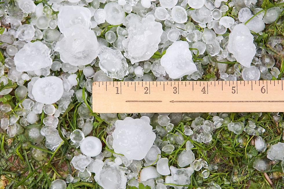
Large Hail, Damaging Winds Possible This Weekend in SE Wyoming
The Cheyenne Office of the National Weather Service says that while we can expect warming temperatures this weekend, more storms with large hail and damaging winds are also a strong possibility.
The agency posted the following on its website:
Daily chances for showers and thunderstorms continue this weekend. Some thunderstorms today may be severe, with large hail and damaging winds being the primary threats. The thunderstorm threat for Saturday and Sunday will be focused over southern portions of southeast Wyoming and much of the Nebraska Panhandle.

Here is the Cheyenne forecast:
Today
Showers and thunderstorms likely, mainly after 3pm. Partly sunny, with a high near 66. North northeast wind around 10 mph. Chance of precipitation is 60%. New rainfall amounts between a half and three quarters of an inch possible.
Tonight
A 50 percent chance of showers and thunderstorms before midnight. Mostly cloudy, then gradually becoming mostly clear, with a low around 50. Northwest wind 5 to 10 mph.
Saturday
Sunny, with a high near 76. North wind 10 to 15 mph.
Saturday Night
Mostly clear, with a low around 52. North northeast wind 5 to 10 mph becoming south southwest after midnight.
Sunday
A 20 percent chance of showers and thunderstorms after noon. Sunny, with a high near 82. West wind 5 to 15 mph becoming north northwest in the afternoon.
Sunday Night
A 20 percent chance of showers and thunderstorms before midnight. Mostly clear, with a low around 53.
Monday
Sunny, with a high near 86.
Monday Night
A slight chance of showers and thunderstorms before midnight. Partly cloudy, with a low around 55.
Tuesday
A chance of showers and thunderstorms after noon. Partly sunny, with a high near 79.
Tuesday Night
Showers likely and possibly a thunderstorm before midnight, then a chance of showers. Mostly cloudy, with a low around 52.
Wednesday
A chance of showers and thunderstorms. Partly sunny, with a high near 67.
Wednesday Night
A chance of showers and thunderstorms. Mostly cloudy, with a low around 52.
Thursday
A chance of showers and thunderstorms. Partly sunny, with a high near 69.
Here is the forecast for Laramie:
Today
Showers and thunderstorms likely after noon. Mostly cloudy, with a high near 59. North northwest wind 5 to 10 mph. Chance of precipitation is 60%. New rainfall amounts between a quarter and half of an inch possible.
Tonight
A 40 percent chance of showers and thunderstorms before midnight. Partly cloudy, with a low around 45. West northwest wind 5 to 10 mph.
Saturday
Sunny, with a high near 71. West northwest wind 10 to 15 mph becoming north in the afternoon.
Saturday Night
Mostly clear, with a low around 52. North wind 5 to 10 mph becoming south southwest after midnight.
Sunday
A 20 percent chance of showers and thunderstorms after noon. Mostly sunny, with a high near 74. West southwest wind 10 to 15 mph becoming north northwest in the afternoon.
Sunday Night
Mostly clear, with a low around 52.
Monday
A 20 percent chance of showers and thunderstorms after noon. Sunny, with a high near 78.
Monday Night
A slight chance of showers and thunderstorms before midnight. Partly cloudy, with a low around 55.
Tuesday
Showers likely and possibly a thunderstorm after noon. Partly sunny, with a high near 72.
Tuesday Night
A chance of showers and thunderstorms before midnight, then a slight chance of showers. Mostly cloudy, with a low around 50.
Wednesday
Showers likely and possibly a thunderstorm. Partly sunny, with a high near 62.
Wednesday Night
A chance of showers and thunderstorms. Mostly cloudy, with a low around 50.
Thursday
A chance of showers and thunderstorms. Partly sunny, with a high near 66.
Popular Movie Franchises That Should Have Ended Sooner
These franchises were fun in their day — but they all outstayed their welcome.
Gallery Credit: Claire Epting
More From KGAB