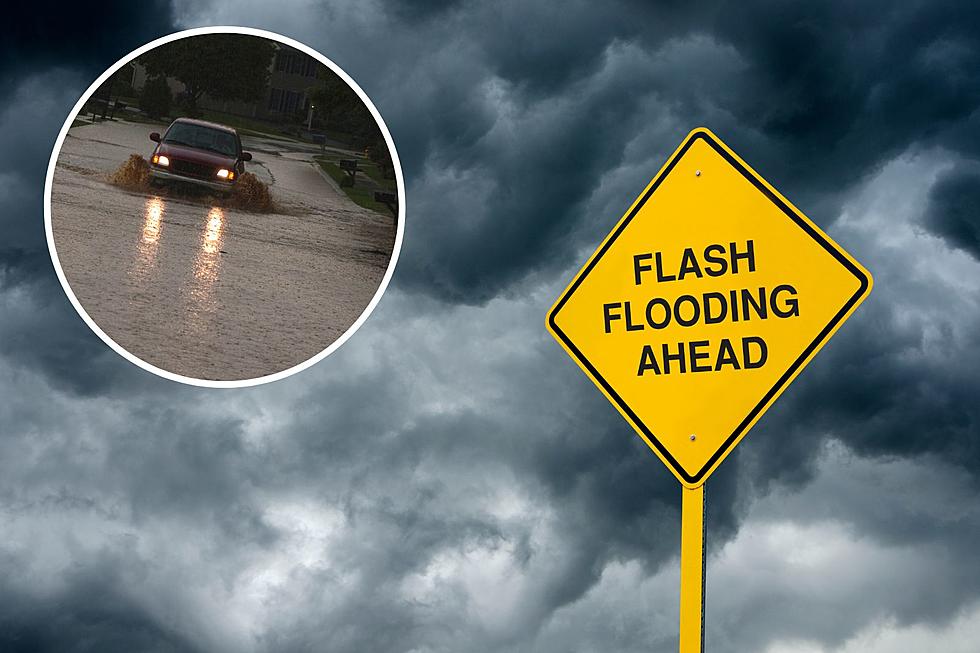
With heavy rain expected across southeast Wyoming on Thursday, a Flood Watch has been posted for most of the area.

That's according to the Cheyenne Office of the National Weather Service.

The watch area includes Cheyenne and Laramie, as well as Douglas, Wheatland and Torrington.

Besides the Flood Watch, severe storms in much of the area are expected to include hail and strong winds.

The agency posted the following on it's website:

Another round of a few strong to severe storms is possible today. Widespread rain, heavy at times, is expected. A few isolated severe storms may contain wind gusts over 60 MPH and hail up to one inch in diameter. Be sure to stay up to date with the forecast!

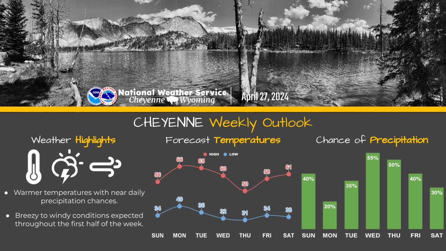
Here is the forecast for Cheyenne:

Today
Showers likely before 9am, then a chance of showers and thunderstorms between 9am and noon, then showers and possibly a thunderstorm after noon. Some of the storms could produce heavy rain. High near 52. Breezy, with a southeast wind 5 to 10 mph becoming north 15 to 20 mph in the afternoon. Winds could gust as high as 30 mph. Chance of precipitation is 90%. New rainfall amounts between a half and three quarters of an inch possible.
Tonight
Showers and possibly a thunderstorm. Some of the storms could produce heavy rain. Low around 41. Breezy, with a north wind 20 to 25 mph, with gusts as high as 35 mph. Chance of precipitation is 80%. New rainfall amounts between a quarter and half of an inch possible.
Friday
Showers likely, with thunderstorms also possible after noon. Some of the storms could produce heavy rain. Cloudy, with a high near 51. Windy, with a north northwest wind 25 to 30 mph, with gusts as high as 40 mph. Chance of precipitation is 70%.
Friday Night
A chance of showers and thunderstorms. Some of the storms could produce heavy rain. Mostly cloudy, with a low around 40. Breezy, with a north northwest wind 20 to 25 mph, with gusts as high as 35 mph. Chance of precipitation is 40%.
Saturday
A slight chance of rain, then a chance of rain and thunderstorms after noon. Partly sunny, with a high near 57. Breezy, with a north wind 15 to 20 mph, with gusts as high as 30 mph. Chance of precipitation is 40%.
Saturday Night
Rain likely and possibly a thunderstorm. Mostly cloudy, with a low around 41. Breezy. Chance of precipitation is 60%.
Sunday
A chance of rain, then rain likely and possibly a thunderstorm after noon. Mostly cloudy, with a high near 52. Chance of precipitation is 70%.
Sunday Night
Rain likely, mainly before midnight. Mostly cloudy, with a low around 43.
Monday
A slight chance of rain, then a chance of rain and thunderstorms after noon. Mostly cloudy, with a high near 58.
Monday Night
Mostly cloudy, with a low around 44.
Tuesday
A chance of rain and thunderstorms. Partly sunny, with a high near 67.
Tuesday Night
A slight chance of rain and thunderstorms. Partly cloudy, with a low around 44.
Wednesday
A chance of rain and thunderstorms. Mostly sunny, with a high near 70.
Here is the Laramie forecast:
Today
A chance of showers before 9am, then a chance of showers and thunderstorms between 9am and noon, then showers and possibly a thunderstorm after noon. Some of the storms could produce heavy rain. High near 46. Breezy, with an east northeast wind 5 to 10 mph becoming north 15 to 25 mph in the afternoon. Chance of precipitation is 90%. New rainfall amounts between a quarter and half of an inch possible.
Tonight
Showers and possibly a thunderstorm. Some of the storms could produce heavy rain. Low around 36. Breezy, with a north wind around 25 mph, with gusts as high as 40 mph. Chance of precipitation is 90%. New rainfall amounts between a half and three quarters of an inch possible.
Friday
Showers, with thunderstorms also possible after noon. Some of the storms could produce heavy rain. High near 42. Breezy, with a northwest wind around 25 mph, with gusts as high as 40 mph. Chance of precipitation is 90%.
Friday Night
A chance of rain showers before 4am, then a chance of rain and snow showers. Some thunder is also possible. Mostly cloudy, with a low around 36. Breezy, with a northwest wind 15 to 25 mph, with gusts as high as 35 mph. Chance of precipitation is 50%.
Saturday
A chance of rain, with thunderstorms also possible after noon. Mostly cloudy, with a high near 47. Northwest wind around 15 mph becoming north northeast in the afternoon. Chance of precipitation is 50%.
Saturday Night
A chance of rain and thunderstorms. Mostly cloudy, with a low around 38. Chance of precipitation is 50%.
Sunday
A chance of rain, then rain likely and possibly a thunderstorm after noon. Mostly cloudy, with a high near 44. Chance of precipitation is 70%.
Sunday Night
A chance of rain. Mostly cloudy, with a low around 40.
Monday
A slight chance of rain, then a chance of rain and thunderstorms after noon. Mostly cloudy, with a high near 54.
Monday Night
Mostly cloudy, with a low around 41.
Tuesday
A chance of rain and thunderstorms. Partly sunny, with a high near 59.
Tuesday Night
A slight chance of rain and thunderstorms. Partly cloudy, with a low around 41.
Wednesday
A chance of rain and thunderstorms. Mostly sunny, with a high near 62.

Thunder Basin Softball 2023

Photos from Thunder Basin softball games in the 2023 season.

More From KGAB