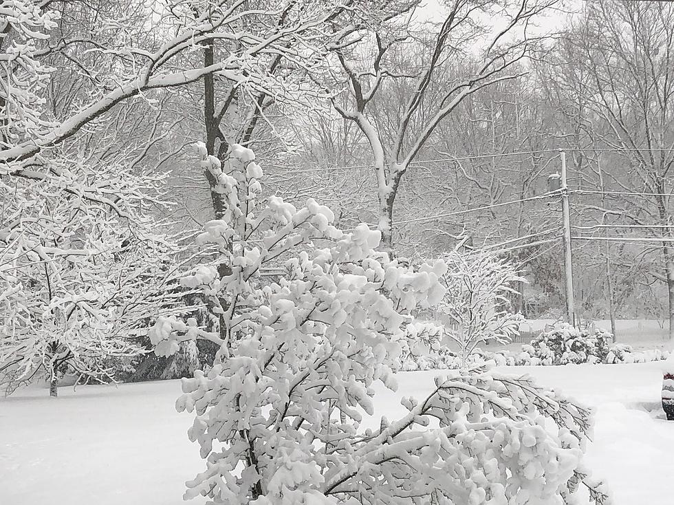
Southeast Wyoming residents can look forward to a wet, snowy weekend, according to the Cheyenne Office of the National Weather Service

Lower elevations are looking at a mix of rain and snow, while higher elevations in the mountains could get up to two feet of snow.

The agency posted the following on its website: Snowy days are ahead for southeast Wyoming and western Nebraska. Friday, Saturday, and Sunday will feature mixed rain and snow showers across with region, with rain showers favored east of I-25 and snow showers favored west of I-25. All days are expected to see snow transitioning to rain and transitioning back to snow along the I-25 corridor. Sunday night into Monday, all rain showers transition to snow showers and come to an end by Monday evening.

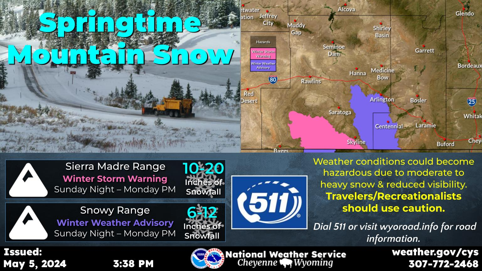
Heavy Snow Expected In SE Wyoming Mountains

Winter Storm Warnings (pink areas) have been issued for the Sierra Madre and Snowy ranges from 6PM this evening through 6PM Sunday. 1 to 2 feet of snow will be possible for the mountains. Strong winds may result in blowing snow and reduced visibility. Snowmobilers and hikers may become disoriented or lost in low visibility from blowing snow. A Winter Weather Advisory (purple area) has been issued for the I-80 Summit from 12PM today through 12PM Saturday. 3-5 inches of snow will be possible in this location. Strong winds may lead to blowing snow and reduced visibility along I-80. Be prepared for winter conditions and use caution if traveling.

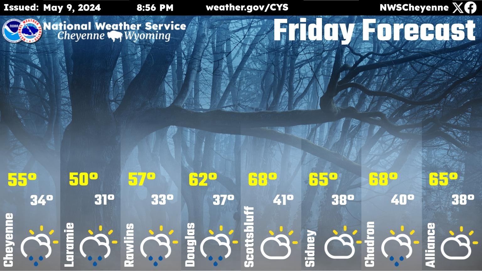
Cheyenne, Laramie Forecasts

Cheyenne Forecast:

Today
A 40 percent chance of snow showers. Mostly cloudy, with a high near 43. Northwest wind 5 to 10 mph.
Tonight
Snow showers. Low around 28. North wind 5 to 15 mph becoming south after midnight. Chance of precipitation is 90%. New snow accumulation of less than a half inch possible.
Saturday
A slight chance of snow showers before noon, then a slight chance of rain showers. Mostly cloudy, with a high near 50. Breezy, with a south wind 10 to 15 mph becoming southwest 20 to 25 mph in the afternoon. Winds could gust as high as 40 mph. Chance of precipitation is 20%.
Saturday Night
Rain showers likely before 8pm, then rain and snow showers likely between 8pm and 5am, then a chance of snow showers after 5am. Mostly cloudy, with a low around 30. South southwest wind 5 to 15 mph. Chance of precipitation is 60%. Little or no snow accumulation expected.
Sunday
A chance of rain and snow showers before noon, then rain showers likely between noon and 5pm, then snow showers likely after 5pm. Mostly cloudy, with a high near 51. Breezy, with a southwest wind 10 to 20 mph, with gusts as high as 30 mph. Chance of precipitation is 70%.
Sunday Night
Snow showers likely, mainly before midnight. Mostly cloudy, with a low around 25. Breezy. Chance of precipitation is 70%.
Monday
A 50 percent chance of snow showers. Mostly cloudy, with a high near 41. Breezy.
Monday Night
Partly cloudy, with a low around 21. Blustery.
Tuesday
Sunny, with a high near 49. Breezy.
Tuesday Night
Mostly clear, with a low around 26.
Wednesday
Sunny, with a high near 58. Breezy.
Wednesday Night
Mostly clear, with a low around 29. Breezy.
Thursday
A slight chance of showers. Mostly sunny, with a high near 59. Breezy.
Laramie Forecast:
Today
A 40 percent chance of snow showers. Mostly cloudy, with a high near 43. Northwest wind 5 to 10 mph.
Tonight
Snow showers. Low around 28. North wind 5 to 15 mph becoming south after midnight. Chance of precipitation is 90%. New snow accumulation of less than a half inch possible.
Saturday
A chance of snow showers before noon, then a slight chance of rain showers. Mostly cloudy, with a high near 50. Breezy, with a south wind 10 to 15 mph becoming southwest 20 to 25 mph in the afternoon. Winds could gust as high as 35 mph. Chance of precipitation is 30%.
Saturday Night
Rain showers likely before 8pm, then rain and snow showers likely between 8pm and 5am, then a chance of snow showers after 5am. Mostly cloudy, with a low around 29. South southwest wind 5 to 15 mph. Chance of precipitation is 60%. Little or no snow accumulation expected.
Sunday
Rain and snow showers likely, becoming all snow after 4pm. Mostly cloudy, with a high near 50. Breezy, with a southwest wind 10 to 15 mph increasing to 15 to 20 mph in the afternoon. Winds could gust as high as 30 mph. Chance of precipitation is 70%.
Sunday Night
Snow showers likely, mainly before midnight. Mostly cloudy, with a low around 24. Breezy. Chance of precipitation is 70%.
Monday
A 50 percent chance of snow showers. Mostly cloudy, with a high near 40. Breezy.
Monday Night
Partly cloudy, with a low around 20. Blustery.
Tuesday
Sunny, with a high near 47. Breezy.
Tuesday Night
Mostly clear, with a low around 25.
Wednesday
Sunny, with a high near 56. Breezy.
Wednesday Night
Mostly clear, with a low around 28. Breezy.
Thursday
A slight chance of showers. Mostly sunny, with a high near 58. Breezy.

Tourist Attractions in Wyoming

Gallery Credit: Kolby Fedore, TSM

More From KGAB