
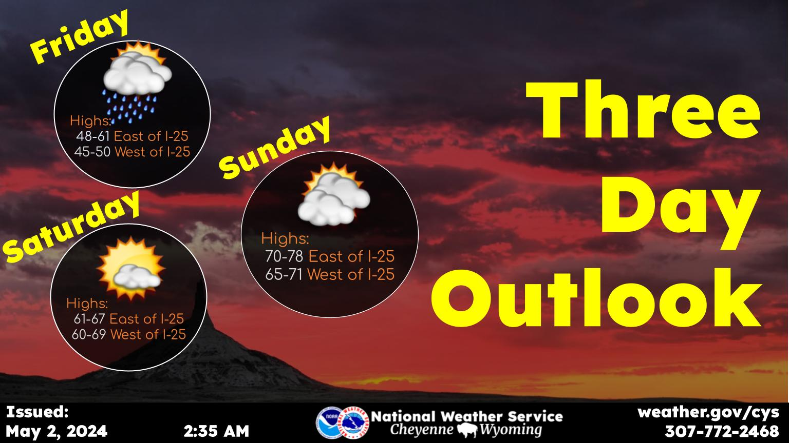
SE Wyoming Flood Watch, Major Flooding Concerns Western Nebraska
The Cheyenne Office of the National Weather Service says a flood watch is in effect for areas of southeast Wyoming east of the Laramie Range through 6 p.m. Saturday:
''Fairly widespread rain is expected to develop through the afternoon today and continue overnight into Saturday. Communities east of the Laramie Range could see significant rainfall through Saturday afternoon. This rain will fall on snowpack from our recent snowstorm that could create flooding issues. Additionally, we are expecting slow-moving thunderstorms that could produce higher rainfall amounts than what we currently have forecasted. A Flood Watch remains in effect for areas east of the Laramie Range through Saturday afternoon. If you encounter flooded roads, please turn around. This could be especially dangerous with the potential for night-time flooding.''
Meanwhile, the weather service is warning about major flooding in parts of western Nebraska:
''With ongoing snowmelt and possible ice jams along the White River in Dawes County coupled with this weekend’s chance of additional rainfall, a Flood Warning is now in effect for all of Dawes County, specifically those along the White River. The river and associated tributaries are already swollen from previous snowmelt and will continue to rise with additional moisture. Portions of the river are topping locations along the Slim Butte Road near the state line. Those who encounter flooded roads while driving should turn around, don’t drown!''
More From KGAB


