UPDATE: The Cheyenne Office of the Nation of the National Weather Service now says Cheyenne is under a blizzard warning starting at 5 p.m. Laramie, meanwhile, now faces a winter storm warning. Both cities had previously been listed as facing only winter weather advisories.

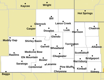
The areas in orange on the map face a blizzard warning, while the pink areas face a winter storm warning:


Map of Forecast Area

Original Post: The Cheyenne Office of the National Weather Service is offering more information on a winter storm that is expected to blast much of southeast Wyoming and the Nebraska Panhandle with near-blizzard-to-blizzard conditions.

Here is the travel forecast on the WYDOT website from Dayweather Inc:

Travel Forecast Map

The National Weather Service posted the following on Facebook late Monday morning:

When: Prolonged event - starting late evening west in Carbon County expanding east to the I-25 Corridor + NE Panhandle early Tues. & continuing to late Weds.
Winds increase from the N/NW early Tues. with gusts of 20-30 mph & ramp up Tues afternoon - late Wed, gusting 40-50 mph. Local whiteout conditions expected from falling/blowing snow. Snow drifts of 1-2 feet probable in red/orange areas of Winter Storm Severity impact image below.
The post added more information on what is expected:
''Extra Details: Prolonged Cold Temperatures! Wind Chills will drop below zero to the negative teens Tuesday morning & continue through at least Thursday. Frost bite could easily be possible for anyone one outside or exposed to these temperatures with out proper layering.
More details: Confidence is high of an impacting winter storm & high winds causing localized blizzard conditions. Snowfall amounts may vary but travel impacts are expected. There will be a sharp snow gradient near/north of Cheyenne & points north/east. Stay tuned & stay safe!''
May be an image of map, sky and text

While Cheyenne and Laramie probably won't get as much snow as some other areas, forecasters can't totally rule out snowfall of as much as 9 inches:

May be an image of map and text

Here are the latest snowfall estimates:

May be an image of map and text

Here is the UPDATEDCheyenne Weather Forecast:

Tonight
Snow, mainly after 11pm. Patchy blowing snow after 1am. Low around 12. Wind chill values between -10 and zero. Blustery, with a north northwest wind 20 to 25 mph, with gusts as high as 40 mph. Chance of precipitation is 90%. New snow accumulation of 2 to 4 inches possible.
Tuesday
Snow. Widespread blowing snow, mainly before 5pm. High near 20. Wind chill values between -10 and zero. Windy, with a north northwest wind 30 to 40 mph, with gusts as high as 55 mph. Chance of precipitation is 90%. New snow accumulation of 1 to 2 inches possible.
Tuesday Night
Snow likely, mainly before 11pm. Areas of blowing snow. Mostly cloudy, with a low around 15. Wind chill values between -10 and zero. Windy, with a northwest wind 25 to 30 mph, with gusts as high as 45 mph. Chance of precipitation is 60%. New snow accumulation of less than one inch possible.
Wednesday
Snow likely, mainly before 11am. Widespread blowing snow, mainly between 8am and 11am. Mostly cloudy, with a high near 25. Windy, with a northwest wind 30 to 35 mph, with gusts as high as 55 mph. Chance of precipitation is 60%.
Wednesday Night
Patchy blowing snow. Mostly cloudy, with a low around 15. Blustery.
Thursday
Patchy blowing snow. Mostly sunny, with a high near 24. Windy.
Thursday Night
Patchy blowing snow. Mostly cloudy, with a low around 9. Blustery.
Friday
Patchy blowing snow. Mostly sunny, with a high near 19. Blustery.
Friday Night
Patchy blowing snow before 10pm. Partly cloudy, with a low around 6. Blustery.
Saturday
Sunny, with a high near 25. Blustery.
Saturday Night
Partly cloudy, with a low around 6. Breezy.
Sunday
Mostly sunny, with a high near 27.
Here is the Laramie Forecast:
This Afternoon
Snow after 5pm. High near 37. Breezy, with a northeast wind around 20 mph, with gusts as high as 30 mph. Chance of precipitation is 80%. Total daytime snow accumulation of less than a half inch possible.
Tonight
Snow. Widespread blowing snow, mainly after 3am. Low around 5. Wind chill values between -5 and -15. Blustery, with a north northeast wind 20 to 25 mph becoming northwest after midnight. Winds could gust as high as 35 mph. Chance of precipitation is 90%. New snow accumulation of 2 to 4 inches possible.
Tuesday
Snow. Widespread blowing snow. High near 12. Wind chill values between -15 and -20. Windy, with a northwest wind 30 to 35 mph, with gusts as high as 55 mph. Chance of precipitation is 100%. New snow accumulation of 2 to 4 inches possible.
Tuesday Night
Snow. Widespread blowing snow. Low around 11. Wind chill values between -5 and -10. Windy, with a west northwest wind 35 to 40 mph, with gusts as high as 55 mph. Chance of precipitation is 90%. New snow accumulation of 2 to 4 inches possible.
Wednesday
Snow. Widespread blowing snow. High near 16. Windy, with a west northwest wind 35 to 40 mph, with gusts as high as 60 mph. Chance of precipitation is 90%.
Wednesday Night
A 30 percent chance of snow, mainly before 11pm. Widespread blowing snow, mainly before 10pm. Mostly cloudy, with a low around 11. Windy.
Thursday
Patchy blowing snow. Partly sunny, with a high near 15. Windy.
Thursday Night
A slight chance of snow after 11pm. Patchy blowing snow. Mostly cloudy, with a low around 6. Blustery.
Friday
A slight chance of snow before 11am. Patchy blowing snow. Partly sunny and cold, with a high near 10. Blustery.
Friday Night
Patchy blowing snow. Partly cloudy, with a low around 2. Blustery.
Saturday
Sunny, with a high near 16. Breezy.
Saturday Night
Partly cloudy, with a low around 6. Breezy.
Sunday
Mostly sunny, with a high near 19. Breezy.

2022's Deadliest Wyoming County in Terms of Traffic Deaths

While car crashes can occur anywhere, some roads in Wyoming are more dangerous than others.

As the numbers stand now, more people have died on the road in Laramie County than in any other county in 2022.

Below is the Wyoming Highway Patrol narrative of every fatal crash that has occurred in Laramie County this year.

More From KGAB