It looks like the hottest day so far of 2024 in southeast Wyoming, with the mercury expected to skyrocket above the 90-degree mark in some areas.

That's according to the Cheyenne Office of the National Weather Service. The agency posted the following on its website:

Look for decreasing clouds this evening with clears skies by midnight. Overnight lows will range from 48 at Dixon to 61 at Chadron. Wednesday looks to be hot, with mid to upper 90s in the Nebraska Panhandle and upper 80s, to low 90s in southeast Wyoming. May see increasing chances for afternoon showers and thunderstorms out near Rawlins and in the Snowy and Sierra Madre Ranges.

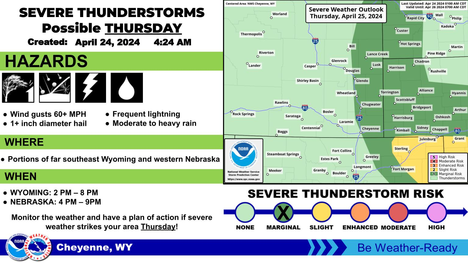
But more rainy weather is expected starting on Thursday:

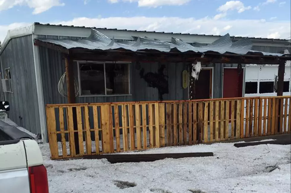
After a brief break, showers and thunderstorms return to the forecast for southeast Wyoming and Nebraska Panhandle from Thursday onward into the weekend. Best chances for more numerous showers and storms, looks to be Friday, when we could see strong to severe storms east of the Laramie Range. Chances for storms slowly decrease through the weekend into Monday. 

Forecast For Cheyenne and Laramie

Cheyenne Forecast:

Today
A 20 percent chance of showers and thunderstorms after noon. Sunny and hot, with a high near 90. West northwest wind around 15 mph.
Tonight
A 20 percent chance of showers and thunderstorms before midnight. Partly cloudy, with a low around 57. West wind 10 to 15 mph.
Thursday
A 30 percent chance of showers and thunderstorms after noon. Sunny, with a high near 85. West northwest wind around 10 mph becoming east southeast in the afternoon.
Thursday Night
Partly cloudy, with a low around 54. Southeast wind 5 to 10 mph.
Friday
A 50 percent chance of showers and thunderstorms after noon. Mostly cloudy, with a high near 80. South southwest wind 5 to 15 mph.
Friday Night
A 20 percent chance of showers and thunderstorms before midnight. Mostly cloudy, with a low around 55.
Saturday
Mostly sunny, with a high near 86.
Saturday Night
Mostly clear, with a low around 52.
Sunday
Sunny, with a high near 84.
Sunday Night
Partly cloudy, with a low around 51.
Monday
Mostly sunny, with a high near 82. Breezy.
Monday Night
Partly cloudy, with a low around 50. Breezy.
Tuesday
Sunny, with a high near 79. Breezy.
Laramie Forecast
Today
A 20 percent chance of showers and thunderstorms after noon. Sunny, with a high near 84. Breezy, with a west wind 15 to 20 mph increasing to 20 to 25 mph in the afternoon. Winds could gust as high as 35 mph.
Tonight
A 20 percent chance of showers and thunderstorms before 9pm. Partly cloudy, with a low around 52. Breezy, with a west wind 15 to 20 mph becoming south southwest 5 to 10 mph after midnight. Winds could gust as high as 30 mph.
Thursday
A 30 percent chance of showers and thunderstorms after noon. Sunny, with a high near 85. South wind 5 to 15 mph becoming west in the afternoon.
Thursday Night
Partly cloudy, with a low around 54. Southwest wind around 10 mph becoming southeast in the evening.
Friday
A 40 percent chance of showers and thunderstorms after noon. Mostly cloudy, with a high near 80. Southwest wind around 10 mph.
Friday Night
A 20 percent chance of showers and thunderstorms before midnight. Mostly cloudy, with a low around 52.
Saturday
Mostly sunny, with a high near 81. Breezy.
Saturday Night
Mostly clear, with a low around 49. Breezy.
Sunday
Sunny, with a high near 81. Breezy.
Sunday Night
Partly cloudy, with a low around 49. Breezy.
Monday
Sunny, with a high near 80. Breezy.
Monday Night
Mostly clear, with a low around 47. Breezy.
Tuesday
Sunny, with a high near 74. Breezy.

Lunar Rainbow: Why the Moon Changes Colors, Explained

When the moon lies on the horizon, the color will be most intense, usually red or orange. When there's more blue light, as during the early morning hours, we're more likely to see purple and blue-tinged moons. Here's why:

Gallery Credit: Phylicia Peterson, Townsquare Media Laramie/Cheyenne

More From KGAB