The Cheyenne Office of the National Weather Service says a ''major winter storm' could dump 12-18 inches of snow in southeast Wyoming on Monday through Wednesday.

The agency posted the following statement Facebook late Saturday afternoon:

This is not an April Fools joke… A major snowstorm is taking shape and likely to impact much of the area Monday through Wednesday this week. A Winter Storm Watch goes into effect Sunday for much of southeast Wyoming and the Nebraska Panhandle and lasts through Wednesday. Exact snowfall amounts remain uncertain at this time, but some locations could see in excess of 12 inches of snow. A sharp snowfall gradient is expected to develop, shown in the yellow box, which could result in significant differences in snow totals over short distances. An expansion of the Winter Storm Watch into eastern Laramie county, and portions of the southern Nebraska Panhandle may be warranted as Monday approaches. In addition to the potential heavy snow, gusty winds may result in blowing and drifting concerns. The Maximum Wind Gust Forecast is shown on the left. Continue to check back for the most up to date weather information as this system approaches.

The agency included the following in an email


Key Messages:

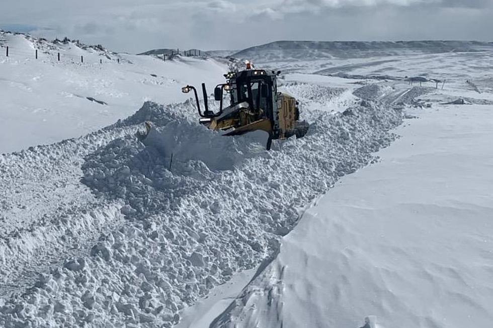
  • A winter storm beginning late Sunday night is set to potentially cause major impacts to portions of southeast Wyoming and western Nebraska due to heavy snow and blowing/drifting snow.
  • Widespread 10 to 15 inches of snowfall is possible, with areas near the Pine Ridge receiving even 20+ inches.
  • Along with the heavy snowfall, strong wind gusts 45 to 55+ mph Tuesday, will cause very hazardous conditions across far eastern Wyoming and the Nebraska panhandle.

Here is the forecast for Cheyenne:

Sunday
Sunny, with a high near 52. Windy, with a west wind 20 to 30 mph, with gusts as high as 45 mph.
Sunday Night
A slight chance of rain and snow before 8pm, then snow likely. Increasing clouds, with a low around 28. Breezy, with a west wind 20 to 25 mph becoming light and variable. Winds could gust as high as 35 mph. Chance of precipitation is 60%. New snow accumulation of less than one inch possible.
Monday
Snow likely, mainly after noon. Mostly cloudy, with a high near 43. Southeast wind 10 to 15 mph, with gusts as high as 25 mph. Chance of precipitation is 70%.
Monday Night
Snow before midnight, then snow, possibly mixed with freezing drizzle between midnight and 4am, then snow after 4am. The snow could be heavy at times. Some thunder is also possible. Widespread blowing snow, mainly after 5am. Low around 16. Blustery. Chance of precipitation is 90%.
Tuesday
Snow. Widespread blowing snow, mainly between 3pm and 4pm. High near 20. Windy. Chance of precipitation is 90%.
Tuesday Night
A slight chance of snow before midnight. Patchy blowing snow. Mostly cloudy, with a low around 9. Windy.
Wednesday
Partly sunny, with a high near 26. Blustery.
Wednesday Night
A slight chance of snow. Mostly cloudy, with a low around 11.
Thursday
Mostly sunny, with a high near 33.
Thursday Night
Partly cloudy, with a low around 15.
Friday
Mostly sunny, with a high near 41.
Friday Night
A slight chance of snow. Partly cloudy, with a low around 23.
Saturday
Mostly sunny, with a high near 46.
Here is the Laramie forecast:
Sunday
A 20 percent chance of snow after noon. Mostly sunny, with a high near 40. Windy, with a west wind 25 to 30 mph, with gusts as high as 45 mph.
Sunday Night
Snow likely, mainly after midnight. Mostly cloudy, with a low around 26. Breezy, with a west wind 20 to 25 mph becoming west 10 to 15 mph after midnight. Winds could gust as high as 35 mph. Chance of precipitation is 70%. New snow accumulation of 1 to 3 inches possible.
Monday
Snow. Patchy blowing snow after 8am. High near 33. Breezy, with a southeast wind 15 to 20 mph, with gusts as high as 30 mph. Chance of precipitation is 90%.
Monday Night
Snow. The snow could be heavy at times. Some thunder is also possible. Patchy blowing snow. Low around 13. Blustery. Chance of precipitation is 100%.
Tuesday
Snow. Widespread blowing snow, mainly after 4pm. High near 15. Blustery. Chance of precipitation is 100%.
Tuesday Night
A chance of snow before midnight. Patchy blowing snow. Mostly cloudy, with a low around 5. Blustery.
Wednesday
Partly sunny, with a high near 20. Blustery.
Wednesday Night
A slight chance of snow. Mostly cloudy, with a low around 8. Blustery.
Thursday
Mostly sunny, with a high near 27.
Thursday Night
Partly cloudy, with a low around 11.
Friday
Mostly sunny, with a high near 33.
Friday Night
A slight chance of snow. Partly cloudy, with a low around 18.
Saturday
A slight chance of snow. Mostly sunny, with a high near 37.
loading...

KEEP READING: Get answers to 51 of the most frequently asked weather questions...

More From KGAB