National Weather Service Issues Winter Weather Advisory for Central Wyoming
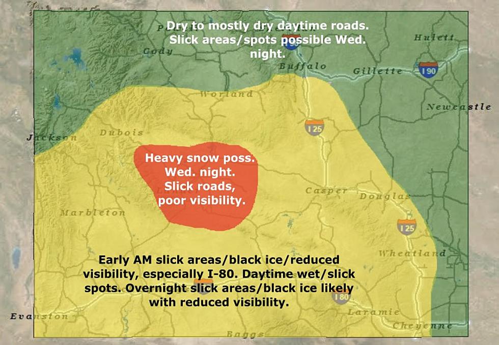
Motorists will encounter slick roads with black ice starting Wednesday evening throughout most of central and southern Wyoming, with heavy snow possible and poor visibility especially in Fremont County, according to the Riverton office of the National Weather Service.
The Weather Service has issued a winter weather advisory and a winter storm warning for much of southeastern Wyoming for the next several days.
Likewise, the Weather Service has issued winter storm watches for the Star Valley and the Wind River Mountains and the Lander foothills through Thursday afternoon.
Snow will develop over southern Wyoming tonight and move north into central Wyoming by Wednesday morning.
In Natrona County, an 80% chance of snow will start Wednesday night, decrease to 70% on Thursday and further decrease to 20% by Friday night. Saturday will be mostly sunny.
Accumulations will not be much -- 1 inch to 3 inches a day. Winds will range from 17 mph to 20 mph.
The storm probably will have the most impact in southern Wyoming.
The Weather Service predicts heavy mixed precipitation expected in the Snowy Range, with total snow accumulations of 10 inches to 15 inches above 9,000 feet, and 6 inches to 10 inches below that. The South Laramie Range could receive between 10 inches and 14 inches with winds gusting as high as 35 mph.
Travel could be very difficult, with patchy blowing snow significantly reducing visibility.
See this video for more information about the storm:

Wild West Photos Brought Back to Life Using Artificial Intelligence
Wild West Photos Brought to Life with Artificial Intelligence
Gallery Credit: Curiosityandbeyond via YouTube
More From KGAB


