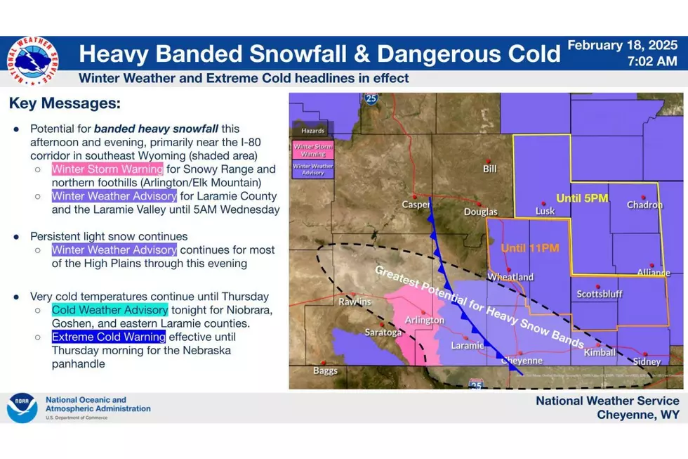
Bands of Intense Snowfall Expected Along I-80 in Southeast Wyoming Today
Several bands of intense snowfall are expected to develop along Interstate 80 in southeast Wyoming this afternoon and evening, the National Weather Service in Cheyenne says.
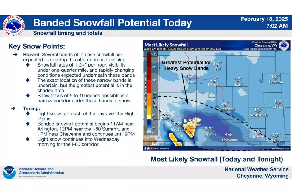
According to the latest briefing packet from the agency, the bands are expected to develop near Arlington at 11 a.m., near the I-80 Summit at noon, and near Cheyenne at 1 p.m., and continue until 9 p.m.

The NWS says snowfall rates of one to two-plus inches per hour, visibility under one-quarter mile, and rapidly changing conditions are expected under these narrow, heavy bands.
Accumulating Snow
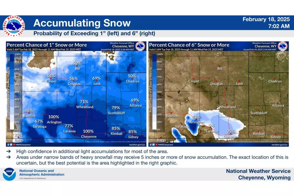
The NWS says widespread accumulations of two to six inches are expected between Elk Mountain and Pine Bluffs, with five to ten inches possible underneath these snow bands.
It says persistent light snow will continue through tonight over much of the High Plains.

Dangerous Cold
As for the ongoing bitterly cold temperatures in place over the High Plains, the NWS says they'll continue until Thursday morning, with tonight being the coldest night.


The Coldest Recorded Temperature in Every State
Gallery Credit: Kristen Matthews
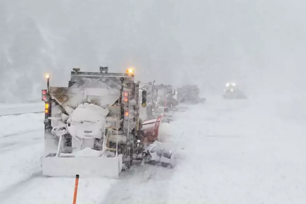
WYDOT Urges 'Don't Crowd the Plow!' After 105 Plows Hit in 5 Years
Gallery Credit: Joy Greenwald
More From KGAB


