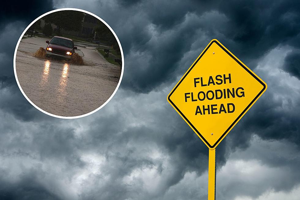
The Cheyenne Office of the National Weather Service says southeast Wyoming and the Nebraska Panhandle can expect increasing chances of heavy rainfall and possible flash flooding over the next few days into the weekend.

The agency posted the following on it's website:

We wanted to advise everyone that we are not done yet with heavy rainfall chances. In fact, chances are increasing across the area for widespread heavy rainfall. Marginal Risks for excessive rainfall will continue Thursday, spreading east Friday into the Nebraska panhandle. Saturday could be quite wet as a Slight Risk area has been identified for much of southeast Wyoming and the entire Nebraska Panhandle. This excessive rainfall could lead to flash flooding for some areas, especially those areas that have recently received substantial rainfall. If out and about and you encounter flooded roads, you may not want to drive through. The roads could be washed out under the flooded waters. Stay tuned to later updates in our forecast as we get closer to these events. Be safe!

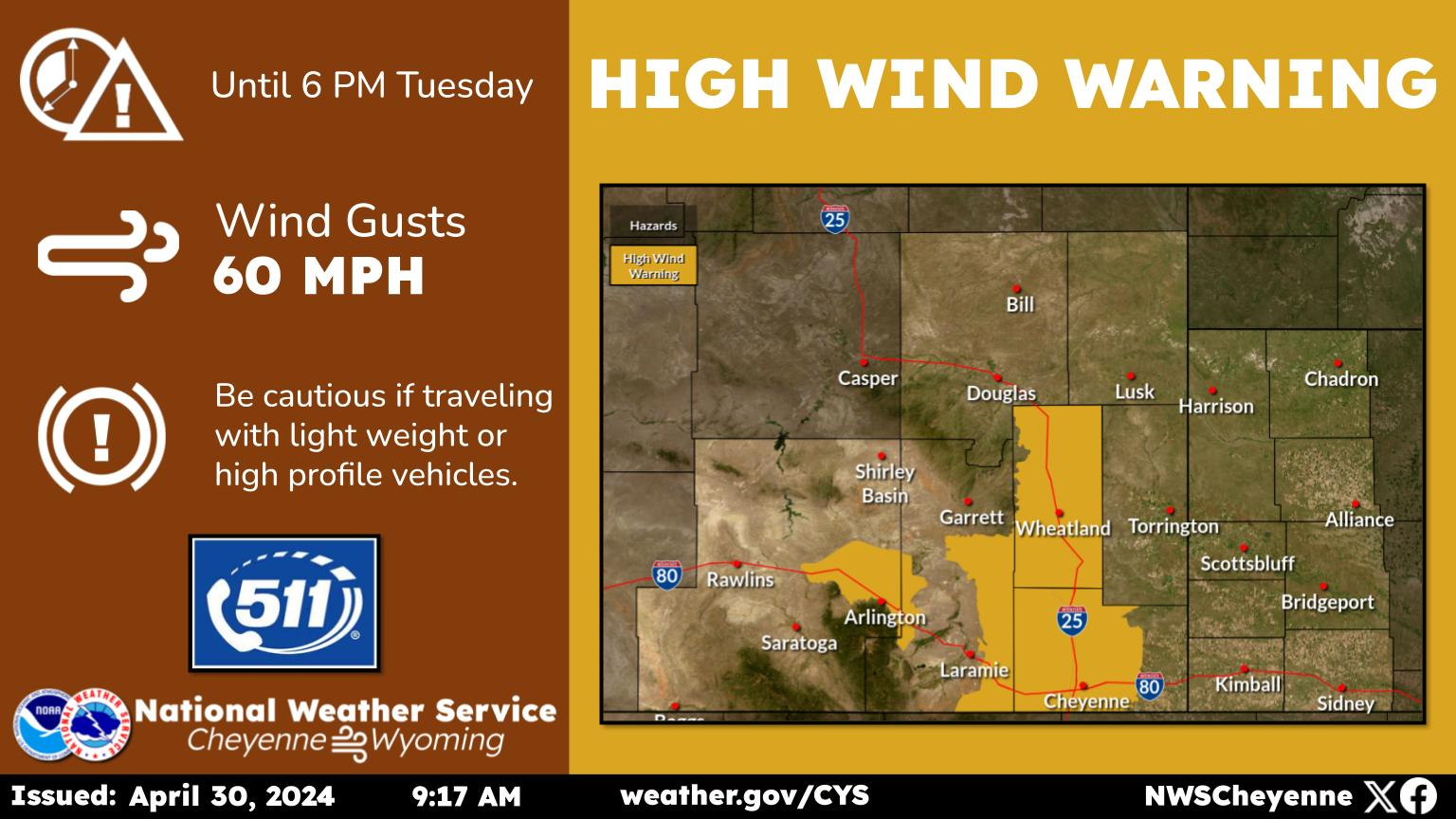
Here is the Cheyenne forecast:

Today
A chance of showers before noon, then showers likely and possibly a thunderstorm between noon and 3pm, then showers and thunderstorms likely after 3pm. Partly sunny, with a high near 72. West wind 5 to 10 mph becoming south southeast in the morning. Chance of precipitation is 60%. New rainfall amounts of less than a tenth of an inch, except higher amounts possible in thunderstorms.
Tonight
A 40 percent chance of showers and thunderstorms before midnight. Mostly cloudy, with a low around 50. Southwest wind 5 to 10 mph.
Friday
A 50 percent chance of showers and thunderstorms after noon. Partly sunny, with a high near 74. West southwest wind 5 to 10 mph becoming east northeast in the afternoon.
Friday Night
A 20 percent chance of showers and thunderstorms before midnight. Mostly cloudy, with a low around 49. West wind 5 to 10 mph.
Saturday
A slight chance of showers and thunderstorms before noon, then showers likely and possibly a thunderstorm between noon and 3pm, then showers and thunderstorms likely after 3pm. Partly sunny, with a high near 72. North wind 5 to 10 mph. Chance of precipitation is 70%.
Saturday Night
Showers and thunderstorms likely before 9pm, then showers likely and possibly a thunderstorm between 9pm and midnight, then a chance of showers and thunderstorms after midnight. Mostly cloudy, with a low around 49. Chance of precipitation is 70%.
Sunday
A chance of showers, then showers likely and possibly a thunderstorm after noon. Cloudy, with a high near 62. Chance of precipitation is 70%.
Sunday Night
A chance of showers and thunderstorms before midnight, then a slight chance of showers. Mostly cloudy, with a low around 49.
Monday
Showers likely and possibly a thunderstorm after noon. Mostly cloudy, with a high near 69.
Monday Night
A chance of showers and thunderstorms before midnight. Mostly cloudy, with a low around 47.
Tuesday
Showers likely and possibly a thunderstorm. Mostly sunny, with a high near 70.
Tuesday Night
A chance of showers and thunderstorms. Mostly cloudy, with a low around 49.
Wednesday
A chance of showers and thunderstorms. Mostly sunny, with a high near 74. Breezy.
Here is the Laramie forecast:
Today
A chance of showers and thunderstorms, then showers and possibly a thunderstorm after 11am. High near 63. Southwest wind 5 to 10 mph becoming south southeast in the morning. Chance of precipitation is 80%. New rainfall amounts between a tenth and quarter of an inch, except higher amounts possible in thunderstorms.
Tonight
A 40 percent chance of showers and thunderstorms before midnight. Mostly cloudy, with a low around 47. Southwest wind 5 to 10 mph.
Friday
Showers likely and possibly a thunderstorm after noon. Partly sunny, with a high near 66. West wind 5 to 10 mph becoming north northwest in the morning. Chance of precipitation is 60%.
Friday Night
A 20 percent chance of showers and thunderstorms before midnight. Mostly cloudy, with a low around 46. West southwest wind 5 to 10 mph.
Saturday
A slight chance of showers and thunderstorms before noon, then showers likely and possibly a thunderstorm between noon and 3pm, then showers and thunderstorms likely after 3pm. Partly sunny, with a high near 63. West wind 5 to 15 mph becoming north in the afternoon. Chance of precipitation is 70%.
Saturday Night
Showers and thunderstorms likely before 9pm, then showers likely and possibly a thunderstorm between 9pm and midnight, then a chance of showers and thunderstorms after midnight. Mostly cloudy, with a low around 46. Chance of precipitation is 60%.
Sunday
A chance of showers, then showers and possibly a thunderstorm after noon. High near 55. Breezy. Chance of precipitation is 80%.
Sunday Night
A chance of showers and thunderstorms before midnight. Mostly cloudy, with a low around 46. Breezy.
Monday
A slight chance of showers, then showers and possibly a thunderstorm after noon. Mostly cloudy, with a high near 60.
Monday Night
A chance of showers and thunderstorms before midnight. Mostly cloudy, with a low around 44.
Tuesday
Showers likely and possibly a thunderstorm. Mostly sunny, with a high near 61.
Tuesday Night
A chance of showers and thunderstorms. Mostly cloudy, with a low around 45. Breezy.
Wednesday
Showers likely and possibly a thunderstorm. Mostly sunny, with a high near 64. Breezy.

Wyoming High School Sports Pics of the Week: June 1-3

Wyoming High School Sports Pics of the Week: June 1-3

More From KGAB