Dam Break Reported in Eastern Wyoming; Flash Flood Warning Issued
UPDATE:
The flash flood warning was canceled later Wednesday.
==============================================================
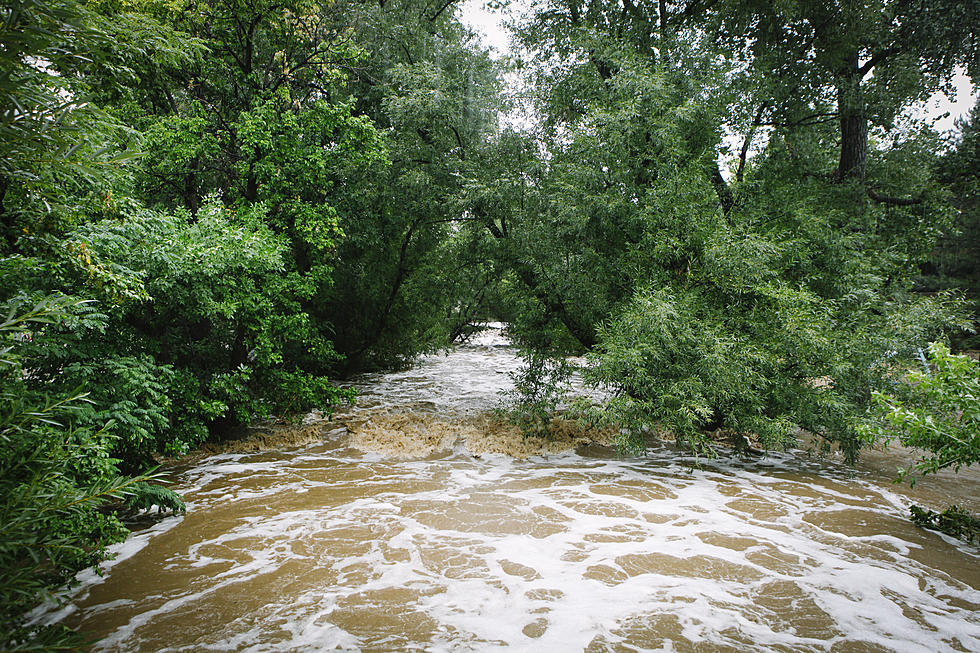
The National Weather Service has issued a flash flood warning following a dam break reported Wednesday afternoon in eastern Wyoming.
According to the warning, which is in effect until 10:15 p.m. Wednesday, a reservoir near Fiddle Back Ranch failed at roughly 4 p.m. Road washouts were reported at Dull Center and Lynch Road.
The warning covers portions of northeastern Converse County and northwestern Niobrara County.
Flood waters are moving into the Cheyenne River Basin. The dam break is expected to cause flooding of small creeks and streams, country roads, farmland and other low-lying areas.
The following streams and drainages are included in the warning:
- West Fork Rattlesnake Draw
- Rat Creek
- Cheyenne River
- Rattlesnake Draw
- Meadow Creek
- Dogie Creek
- East Fork Rattlesnake Draw
- Wagonhound Creek
- Calf Draw
- Wildcat Creek
- Snyder Creek
- Sheldon Draw
- Owl Creek
- Coal Bank Draw
- Hooligan Draw
- Dry Fork Cheyenne River
- East Fork Lake Creek
- Tena Creek
- Coyote Creek
- North Pasture Draw
- Spring Creek
- Bull Creek
- Keyton Creek
- Bad Creek
- M Creek
- Boggy Creek
- Woody Creek
- Cottonwood Draw
- Horse Creek
- Antelope Creek.
The NWS reminds drivers to turn around in the event of encountering flooded roads. Do not drive into floodwaters, even if they do not seem deep, as the road surface beneath may be compromised. Most flood deaths occur in vehicles.
More From KGAB