Cheyenne National Weather Service Warns Of Weather Hazards
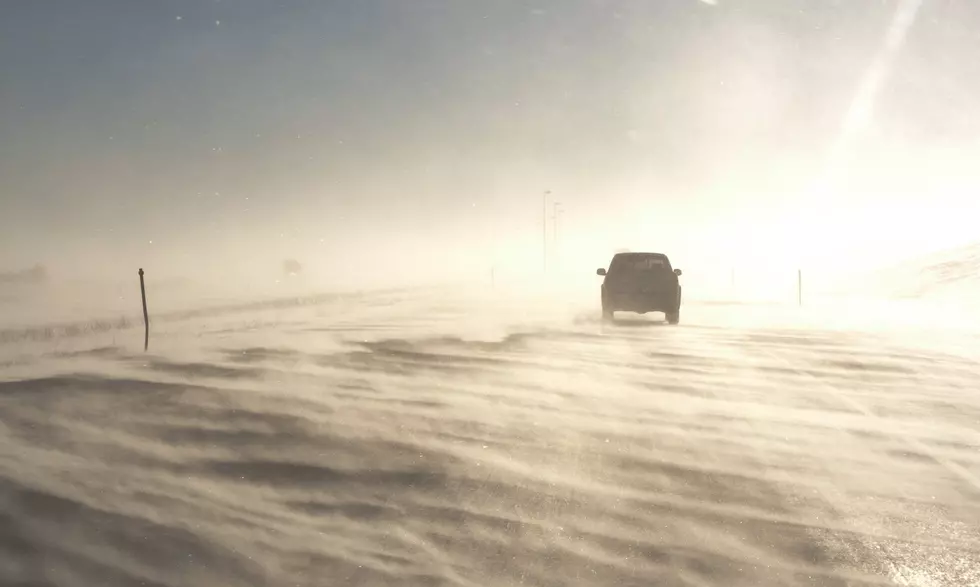
The Cheyenne Office of the National Weather Service is warning about weather hazards in some areas today, especially west of the Laramie Range.
The agency posted this statement on Wednesday morning:
''A fast moving weather system will bring rapidly changing weather conditions to the area today and tonight. High temperatures for most areas will likely be met by late morning or early afternoon as the cold front passes, with considerably colder temperatures expected over the next several days and nights. This storm will be accompanied by a few, mainly localized weather hazards today. 1) High winds are already occurring this morning in the Arlington and Elk Mountain area along Interstate 80 between Laramie and Rawlins, with gusts to 60 MPH reported earlier this morning. This will create hazardous travel for light and high profile vehicles through at least early this afternoon. A High Wind Warning is in effect until 5 PM MST today. Next, snow showers and a few snow squalls are expected to develop over areas west of the Laramie Range later this morning and continuing through the afternoon. These squalls could result in very rapid changes in weather and road conditions over short distances. Those with travel plans across Carbon and Albany counties this afternoon should be mindful of this possibility. Finally, Winter Storm Warnings remain in effect for the Snowy and Sierra Madre mountain ranges through Thursday with 7-14 inches of total snowfall accumulation expected in the high country. Expect dangerous mountain travel. Outdoor recreation will also be hazardous to those not prepared for severe winter conditions.''
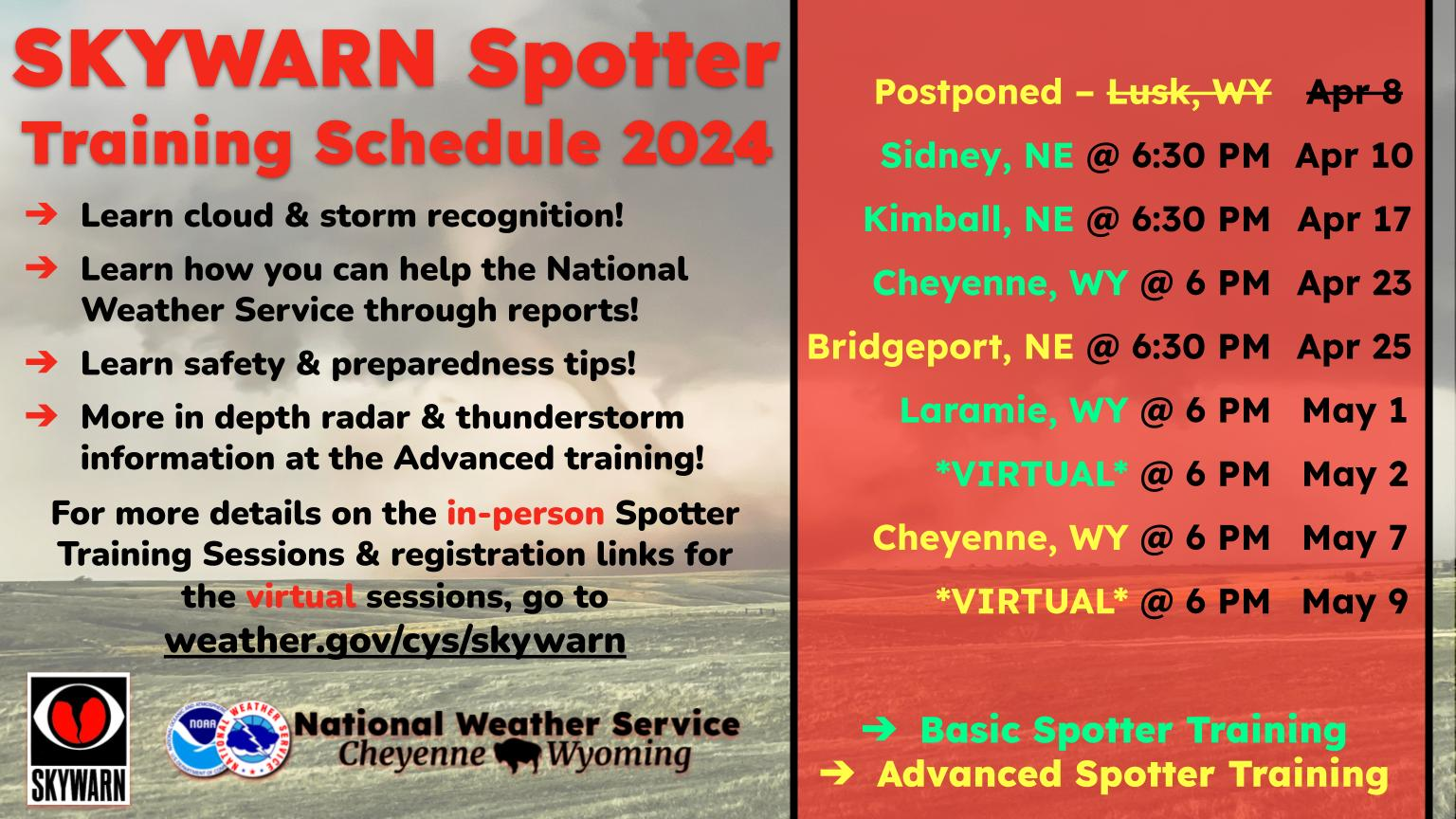
The agency also has posted this timeline for potential travel hazards:


LOOK: Pictures of Downtown Cheyenne Then and Now
More From KGAB


