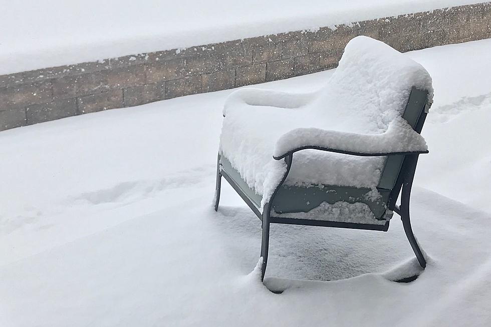
Cheyenne, Laramie Expecting Snow, Advisory Issued For Mountains
The Sierra Madre and Snowy Range mountains in southeast Wyoming are under a winter weather advisory starting at 9 am today, according to the Cheyenne Office of the National Weather Service.
While Cheyenne and Laramie aren't under the advisory, both communities are expecting snow, with over four inches possible in Laramie.
That's according to a post on the agency's website:
Winter Weather Advisories are in effect for the Snowy and Sierra Madre Mountain Ranges where 6 to 12 inches are possible Friday and Saturday morning. Primary concerns are the difficult mountain travel and dangerous outdoor recreation due to reduced visibilities from falling and blowing snow.
Here is the forecast for Cheyenne:
Today
A 40 percent chance of snow showers, mainly after 3pm. Partly sunny, with a high near 44. Breezy, with a northwest wind 10 to 15 mph increasing to 20 to 25 mph in the afternoon. Winds could gust as high as 35 mph.
Tonight
A 50 percent chance of snow showers. Mostly cloudy, with a low around 21. Blustery, with a north wind 15 to 20 mph decreasing to 5 to 10 mph after midnight. Winds could gust as high as 30 mph.
Saturday
A 30 percent chance of snow showers. Mostly cloudy, with a high near 40. North wind 5 to 10 mph becoming south in the afternoon.
Saturday Night
A 20 percent chance of snow showers before midnight. Mostly cloudy, with a low around 25. South southwest wind 5 to 10 mph.
Sunday
Mostly sunny, with a high near 51. Southwest wind 5 to 10 mph.
Sunday Night
Mostly cloudy, with a low around 32.
Monday
A 30 percent chance of showers and thunderstorms after noon. Partly sunny, with a high near 58.
Monday Night
Showers likely. Mostly cloudy, with a low around 34.
Tuesday
Showers likely, then showers and possibly a thunderstorm after noon. Mostly cloudy, with a high near 45.
Tuesday Night
Rain showers likely before 8pm, then rain and snow showers likely between 8pm and 4am, then a chance of snow showers after 4am. Mostly cloudy, with a low around 29.
Wednesday
A chance of rain and snow showers. Mostly cloudy, with a high near 43.
Wednesday Night
Mostly cloudy, with a low around 31.
Thursday
A slight chance of showers. Mostly sunny, with a high near 60. Breezy.
Here is the Laramie forecast:
Today
A 50 percent chance of snow showers, mainly after noon. Increasing clouds, with a high near 34. Windy, with a west northwest wind 15 to 20 mph increasing to 25 to 30 mph in the afternoon. Winds could gust as high as 40 mph.
Tonight
Snow showers likely, mainly before midnight. Mostly cloudy, with a low around 16. Blustery, with a northwest wind 15 to 20 mph becoming south southeast 5 to 10 mph after midnight. Winds could gust as high as 30 mph. Chance of precipitation is 60%. New snow accumulation of 2 to 4 inches possible.
Saturday
A 50 percent chance of snow showers. Mostly cloudy, with a high near 32. North wind 5 to 10 mph.
Saturday Night
A 20 percent chance of snow showers before midnight. Cloudy, then gradually becoming partly cloudy, with a low around 21. Northeast wind 5 to 10 mph becoming southwest after midnight.
Sunday
Mostly sunny, with a high near 44. West wind 5 to 10 mph.
Sunday Night
Mostly cloudy, with a low around 28.
Monday
A chance of snow showers before 3pm, then a chance of rain showers between 3pm and 5pm, then a chance of rain and snow showers after 5pm. Some thunder is also possible. Partly sunny, with a high near 49. Chance of precipitation is 40%.
Monday Night
Rain and snow showers likely before 1am, then a chance of snow showers. Mostly cloudy, with a low around 30.
Tuesday
Snow showers. Some thunder is also possible. Mostly cloudy, with a high near 38. Breezy.
Tuesday Night
Snow showers likely, mainly before midnight. Mostly cloudy, with a low around 25. Blustery.
Wednesday
A chance of snow showers. Mostly cloudy, with a high near 37.
Wednesday Night
A slight chance of snow showers. Partly cloudy, with a low around 28.
Thursday
A slight chance of rain and snow showers. Partly sunny, with a high near 51. Breezy.
These 29 Cities Have Bigger Populations Than Wyoming's 581,000
More From KGAB


