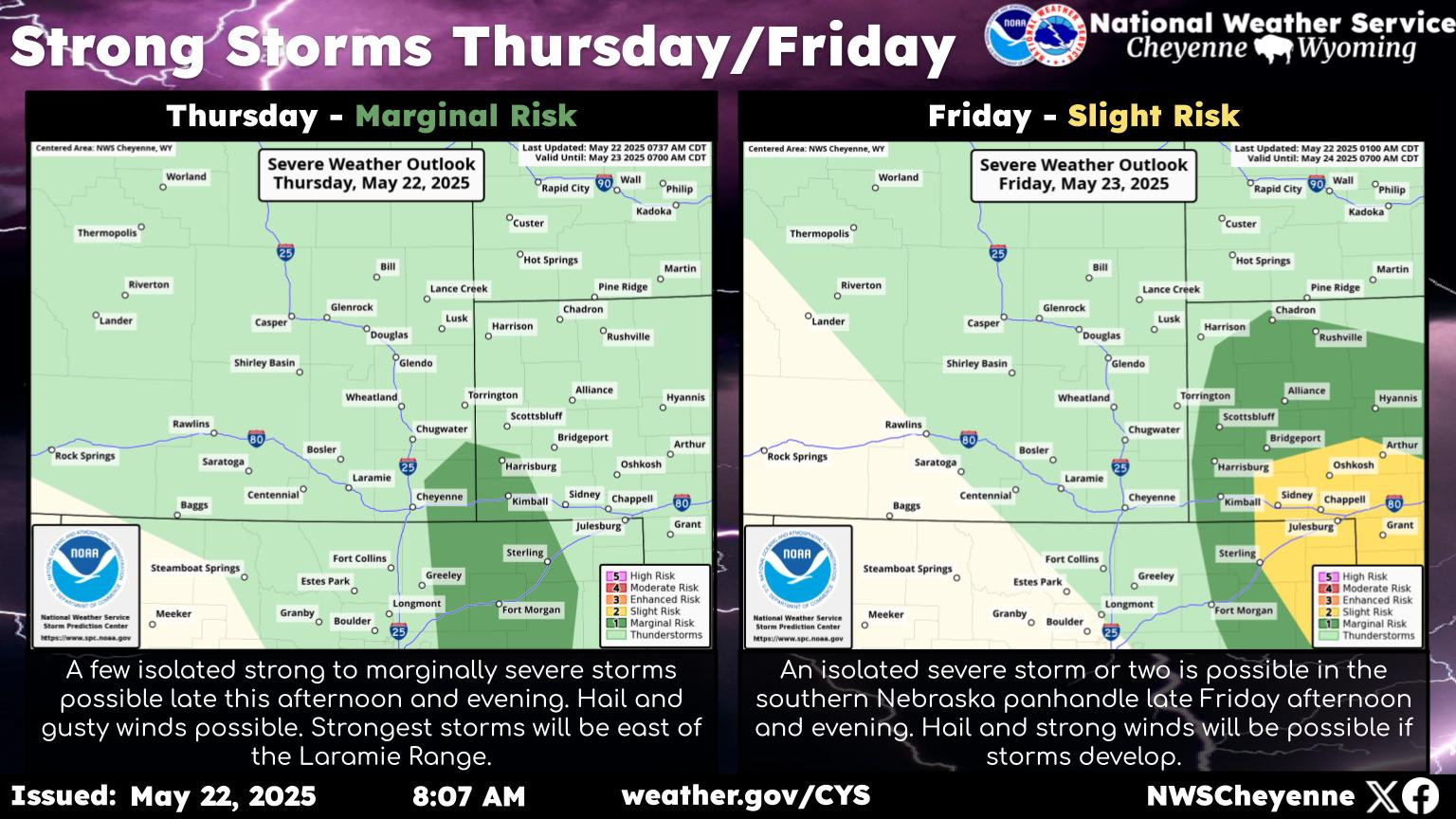
Quarter-Size Hail, Flash Flooding Possible In SE Wyoming Thursday
The Cheyenne office of the National Weather Service says some strong to severe storms are possible in Southeast Wyoming and the Nebraska Panhandle on Thursday and Friday.
The storms could produce fairly large hail, heavy rain, and strong winds,
The agency posted this statement on its website on Thursday morning:
''Looking at the forecast for today and tonight across southeast Wyoming and Nebraska Panhandle, we're looking at increasing chances for showers and thunderstorms as the day progresses. The entire Nebraska Panhandle and much of southeast Wyoming are in a Marginal Risk area for severe thunderstorms today. Timing-wise, storms really get going after 10 AM out west, spreading eastward through the afternoon. Storms will be capable of producing hail to the size of quarters, 60 mph downburst winds and frequent lightning. Storms will also be capable of producing very heavy rainfall, leading to localized flash flooding. Storms will continue into the evening hours and are expected to persist through midnight, before ending from west to east. Stay alert to rapidly changing conditions. Storms will be more isolated and slightly weaker Friday but lightning and localized heavy rain could still be a hazard during the afternoon."
More From KGAB


