
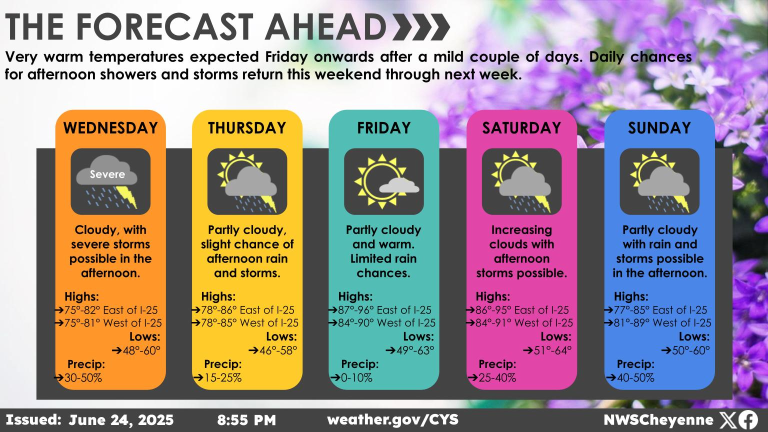
Large Hail, A Few Tornadoes Possible In Parts Of Eastern Wyoming
The Cheyenne Office of the National Weather Service has issued a weather statement for two rounds of severe weather that are possible in parts of eastern Wyoming and the Nebraska Panhandle starting later today.
The agency issued an email that included the following key points:
● Isolated to scattered strong to severe thunderstorms possible today and tonight.
● Large hail up to size of ping pong ball or larger, 60-70 mph winds, and a tornado or two can’t be ruled out. Tornado threat highest across parts of Converse into Niobrara and North NE Panhandle. Timing: 2 pm to 11 pm overall 2 Rounds with first very conditional round from 2-7pm & a second round from 8p-2a. Main risks 1st round will be large hail/tornado - 2nd round: hail/elevated winds

A high wind event which forecasters are calling "not your typical wind event" is also possible in parts of southeast Wyoming later today:
Here we go! First middle to upper tier high wind event of the season on deck tonight especially into Saturday morning. Blowoffs and Blow overs of light/high-profile vehicles is likely on exposed open roadways where 55mph wind gusts are highlighted. Main window will be from 9pm tonight to 3pm Saturday with the worst from 3am to 11am Saturday. Please be aware of your load. Additionally, many trees still have leaves and branches/trees could fall.. Sporadic power outages could be possible. Conditions improve Saturday evening into Sunday.

This Gorgeous Teton Ranch is a Wild West Paradise
Gallery Credit: Phylicia Peterson, Townsquare Media Laramie/Cheyenne
More From KGAB


