Huge Hail Pummels Parts of Southeast Wyoming and the Nebraska Panhandle
A supercell thunderstorm dropped hail larger than softballs in southern Sioux County, Nebraska Tuesday evening, according to the National Weather Service in Cheyenne.
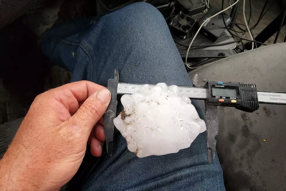
Severe weather spotter Dan Fitts captured the above shot of a 4.3-inch hail stone that fell in open range 20 miles north of Morrill, or 10 miles southwest of Agate Fossil Beds National Monument, around 6 p.m.
"I picked it up within minutes of it falling," Fitts said in a Facebook comment. "There were actually quite a lot of them that fell in about a 2.5 mile wide swath which is actually quite impressive!"
"Here's my cooler of the ones I jumped out and grabbed in the absolutely pouring rain while wearing my motorcycle helmet for safety," Fitts added.

Large hail was also reported in northern Goshen County, Wyoming.
Nichole Walker Smith says it hit her place in Jay Em, and one of the hail stones went through her car's windshield.
The NWS says the supercell started near Douglas, Wyoming around 2 p.m., and its tallest radar sampled cloud top heights reached 60,000 feet in the air.
LOOK: The most expensive weather and climate disasters in recent decades
More From KGAB


