Winter Weather Advisories and Warnings remain in effect for mountain areas of southeast Wyoming today.

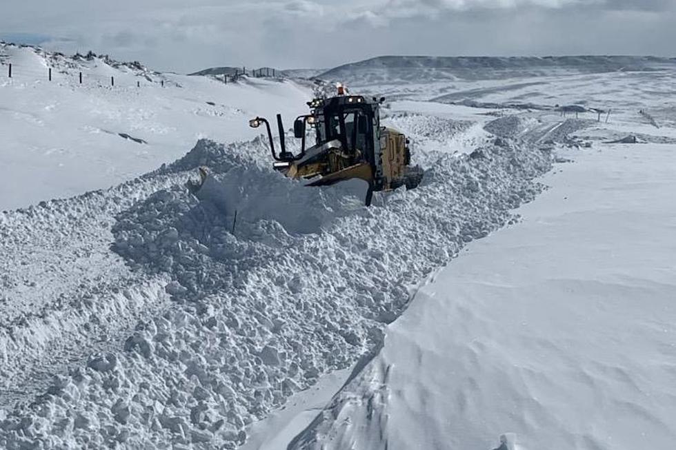
That's according to the Cheyenne Office of the National Weather Service. The agency says higher elevations in some areas could get over a foot of snow:

Winter Weather Advisories and Warnings remain in effect for the Snowy, Sierra Madre and North Laramie Range through noon. Total snowfall accumulations will be up to a foot in the northern Laramie Range and Ferris mountains with mainly 3 to 6 inches in the lower elevations of Converse, Carbon, Niobrara and northern Albany counties. Dense fog will also reduce the visibility to a quarter of a mile or less in Laramie county which includes Cheyenne through mid-morning. Areas of fog will also reduce the visibility between Laramie and Rawlins at times. Please slow down and allow extra time to reach your destination


Cheyenne, Laramie Forecasts

Cheyenne Forecast

Today
A 40 percent chance of snow. Areas of dense fog before 11am. Otherwise, cloudy, with a high near 36. North wind 10 to 15 mph.
Tonight
A 20 percent chance of snow before midnight. Mostly cloudy, then gradually becoming mostly clear, with a low around 22. North wind 5 to 15 mph becoming west southwest after midnight.
Thursday
Sunny, with a high near 47. West southwest wind 10 to 15 mph becoming south in the afternoon.
Thursday Night
Mostly clear, with a low around 26. South wind 5 to 10 mph becoming west in the evening.
Friday
Sunny, with a high near 55. West wind 10 to 15 mph becoming south in the afternoon.
Friday Night
Partly cloudy, with a low around 28.
Saturday
Mostly sunny, with a high near 55.
Saturday Night
Mostly cloudy, with a low around 30.
Sunday
Mostly cloudy, with a high near 51.
Sunday Night
A slight chance of rain showers before midnight, then a chance of rain and snow showers. Mostly cloudy, with a low around 28.
Monday
A chance of rain and snow showers. Partly sunny, with a high near 39. Breezy.
Monday Night
A chance of snow showers. Partly cloudy, with a low around 22.
Tuesday
A slight chance of snow showers. Mostly sunny, with a high near 44.


Laramie Forecast

Today
Snow likely, mainly before noon. Widespread dense fog before noon. Otherwise, cloudy, with a high near 28. North northwest wind 10 to 15 mph. Chance of precipitation is 60%. Total daytime snow accumulation of around an inch possible.
Tonight
A slight chance of snow before 9pm, then a chance of flurries between 9pm and midnight. Patchy blowing snow after 11pm. Mostly cloudy, then gradually becoming mostly clear, with a steady temperature around 23. Windy, with a west wind 15 to 20 mph increasing to 25 to 30 mph after midnight. Winds could gust as high as 40 mph. Chance of precipitation is 20%.
Thursday
Patchy blowing snow before 2pm. Sunny, with a high near 39. Windy, with a west southwest wind 25 to 30 mph decreasing to 15 to 20 mph in the afternoon. Winds could gust as high as 40 mph.
Thursday Night
Mostly clear, with a low around 25. Southwest wind around 15 mph.
Friday
Mostly sunny, with a high near 44. Breezy, with a west southwest wind 10 to 20 mph.
Friday Night
Partly cloudy, with a low around 31.
Saturday
Partly sunny, with a high near 47.
Saturday Night
Mostly cloudy, with a low around 29.
Sunday
Partly sunny, with a high near 42.
Sunday Night
A chance of snow showers, mainly after midnight. Mostly cloudy, with a low around 26.
Monday
Snow showers likely. Partly sunny, with a high near 28.
Monday Night
A chance of snow showers. Partly cloudy, with a low around 19.
Tuesday
A chance of snow showers. Mostly sunny, with a high near 33.

Skeleton Hoard Attacks Wyoming Radio Tower

Gallery Credit: Glenn Woods


More From KGAB