Cheyenne, Laramie Could Face Large Hail, Heavy Rain Today
Southeast Wyoming including both Cheyenne and Laramie could face severe storms this afternoon and evening, according to the Cheyenne Office of the National Weather Service.
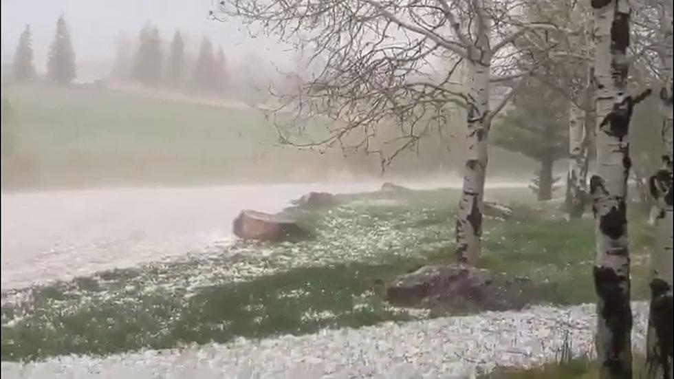
The agency posted the following on its website: There is a marginal to slight risk of severe weather across portions of southeast Wyoming and western Nebraska today. The main concerns will be damaging winds, large hail, and heavy rain. Strongest storms can be expected between 1 PM and 7 PM today.

Cheyenne, Laramie Forecasts
Cheyenne Forecast
Today
A chance of showers and thunderstorms before noon, then showers and possibly a thunderstorm between noon and 3pm, then showers and thunderstorms likely after 3pm. Some of the storms could be severe. High near 67. North wind 10 to 15 mph. Chance of precipitation is 80%. New rainfall amounts between a quarter and half of an inch possible.
Tonight
A 20 percent chance of showers and thunderstorms before midnight. Partly cloudy, with a low around 46. Northwest wind 5 to 10 mph.
Wednesday
Sunny, with a high near 78. Northwest wind 5 to 10 mph becoming south southwest in the afternoon.
Wednesday Night
Mostly clear, with a low around 52. South wind 5 to 10 mph becoming west after midnight.
Juneteenth
Sunny, with a high near 89. West wind 5 to 10 mph becoming south in the afternoon.
Thursday Night
Mostly clear, with a low around 58.
Friday
Sunny and hot, with a high near 92. Breezy.
Friday Night
Mostly clear, with a low around 57.
Saturday
Sunny and hot, with a high near 92.
Saturday Night
Mostly clear, with a low around 57.
Sunday
Sunny, with a high near 87.
Sunday Night
A chance of showers and thunderstorms. Mostly cloudy, with a low around 49.
Monday
A chance of showers and thunderstorms. Mostly sunny, with a high near 74.
Laramie Forecast
Today
A chance of showers and thunderstorms before noon, then showers likely and possibly a thunderstorm between noon and 3pm, then showers and thunderstorms likely after 3pm. Mostly cloudy, with a high near 68. East northeast wind 10 to 15 mph becoming north in the afternoon. Chance of precipitation is 60%. New rainfall amounts between a tenth and quarter of an inch, except higher amounts possible in thunderstorms.
Tonight
A 40 percent chance of showers and thunderstorms, mainly before 9pm. Partly cloudy, with a low around 43. North wind 10 to 15 mph becoming light and variable after midnight.
Wednesday
Sunny, with a high near 78. South southwest wind 5 to 10 mph becoming northwest in the afternoon.
Wednesday Night
Mostly clear, with a low around 49. West wind 5 to 10 mph becoming south in the evening.
Juneteenth
Increasing clouds, with a high near 86. Southwest wind 5 to 10 mph.
Thursday Night
Mostly clear, with a low around 55.
Friday
Sunny, with a high near 87. Breezy.
Friday Night
Clear, with a low around 54. Breezy.
Saturday
Sunny, with a high near 87. Breezy.
Saturday Night
Mostly clear, with a low around 54. Breezy.
Sunday
Sunny, with a high near 84. Breezy.
Sunday Night
A slight chance of showers and thunderstorms. Partly cloudy, with a low around 48.
Monday
A slight chance of showers and thunderstorms. Mostly sunny, with a high near 75.
Laramie County's Most Wanted Fugitives
The Laramie County Sheriff's Office is currently looking for these individuals:
Gallery Credit: Joy Greenwald
More From KGAB


