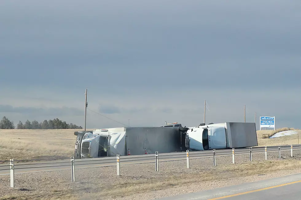
75 MPH Winds Possible In SE Wyoming Thursday And Friday
High Wind Warnings have been issued for areas of southeast Wyoming today [Jan. 23] and Friday, with some winds expected to top out near or above hurricane force, which is 74 miles per hour.

Get our free mobile app
That's according to the Cheyenne Office of the National Weather Service.
The agency posted the following on it's website:
High Wind Watch has been upgraded to a High Wind Warning for portions of southeast Wyoming. Winds will start increasing early this morning and will continue through early Friday. Gusts up to 75 mph possible in the wind prone areas, with gusts of 55 to 65 mph for the lower elevations of Carbon County.

Cheyenne, Laramie Forecast
Cheyenne Forecast
Today
Sunny, with a high near 25. Wind chill values between -5 and 5. Windy, with a northwest wind 20 to 30 mph, with gusts as high as 45 mph.
Tonight
Partly cloudy, with a temperature rising to around 25 by 5am. Wind chill values between zero and 10. Windy, with a west wind 20 to 25 mph increasing to 25 to 30 mph after midnight. Winds could gust as high as 50 mph.
Friday
A 30 percent chance of snow after 11am. Partly sunny, with a high near 36. Breezy, with a west wind 15 to 25 mph, with gusts as high as 40 mph.
Friday Night
Snow likely. Cloudy, with a low around 11. North wind around 10 mph. Chance of precipitation is 70%. New snow accumulation of 1 to 2 inches possible.
Saturday
Snow likely. Cloudy, with a high near 14. North wind around 10 mph. Chance of precipitation is 70%.
Saturday Night
A 30 percent chance of snow, mainly before 11pm. Mostly cloudy, with a low around 2.
Sunday
Mostly sunny, with a high near 24.
Sunday Night
Mostly clear, with a low around 8.
Monday
Sunny, with a high near 37.
Monday Night
Mostly clear, with a low around 15.
Tuesday
A slight chance of flurries. Sunny, with a high near 38.
Tuesday Night
Mostly clear, with a low around 15.
Wednesday
Sunny, with a high near 38.
Laramie Forecast
Today
Patchy blowing snow before 5pm. Sunny, with a high near 14. Wind chill values between -10 and -15. Windy, with a west northwest wind around 30 mph, with gusts as high as 45 mph.
Tonight
Patchy blowing snow between 8pm and 2am. Mostly clear, with a temperature rising to around 15 by 5am. Wind chill values between -5 and -15. Windy, with a west southwest wind 25 to 30 mph, with gusts as high as 40 mph.
Friday
A 50 percent chance of snow after 11am. Increasing clouds, with a high near 26. Wind chill values between -5 and 5. Windy, with a west southwest wind 25 to 30 mph decreasing to 20 to 25 mph in the afternoon. Winds could gust as high as 45 mph.
Friday Night
Snow. Low around 6. Wind chill values between -5 and zero. Northwest wind 10 to 15 mph becoming northeast in the evening. Chance of precipitation is 80%. New snow accumulation of 2 to 4 inches possible.
Saturday
Snow likely. Cloudy and cold, with a high near 9. Northeast wind 5 to 10 mph. Chance of precipitation is 70%.
Saturday Night
A 50 percent chance of snow. Mostly cloudy, with a low around 0.
Sunday
Mostly sunny, with a high near 16.
Sunday Night
Mostly clear, with a low around 2.
Monday
Sunny, with a high near 27.
Monday Night
Mostly clear, with a low around 9.
Tuesday
A slight chance of flurries. Sunny, with a high near 30.
Tuesday Night
Mostly clear, with a low around 11.
Wednesday
Sunny, with a high near 30.
LOOK: Rare Two Headed Animal Discoveries
Gallery Credit: Kolby Fedore, Townsquare Media
More From KGAB


