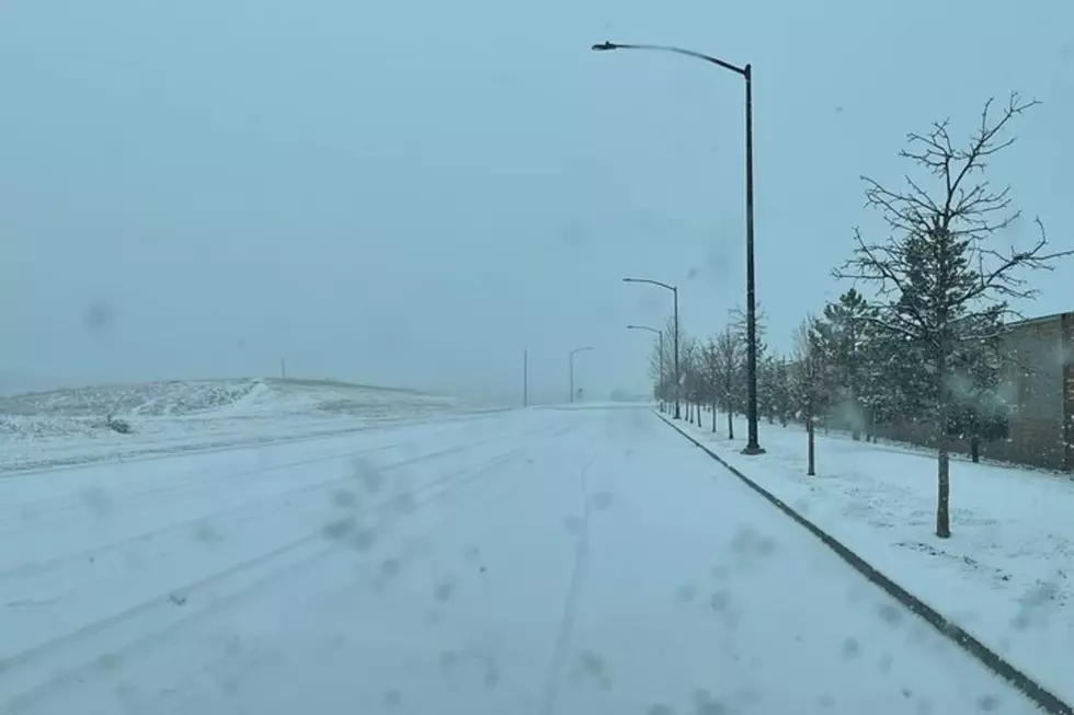
A winter cold front and strong winds are expected to blast southeast Wyoming and the Nebraska Panhandle this weekend.

Besides snowfall and potentially slick roads, wind speeds could hit 75 mph in some areas.

That's according to the Cheyenne Office of the National Weather Service. The agency posted the following on its website:

''Weather is going to be very hectic Friday into the weekend across southeast Wyoming and the Nebraska Panhandle. Winds will be increasing Friday as a cold front approaches from the west. Warm temperatures and windy conditions likely to lead to critical fire weather conditions east of the Laramie Range Friday afternoon. Winds will continue to increase Friday evening into Saturday as the front draws closer. High Wind Watches in effect for many areas Friday night into Saturday. As the front moves through, look for increasing chances for snow behind the front and rain showers/thunderstorms in the Panhandle Saturday afternoon. Colder temperatures behind the front expected to turn to all snow. Winter Storm Watches in effect for many areas Saturday night through Sunday night. Check the weather forecast before you head out this weekend. It may save you some grief and keep you from getting stuck somewhere you weren't intending''

Strong Winds Expected


Wind Gust Timeline ➔ West winds 40 to 50 MPH with gusts to 75 MPH possible for the wind prone areas of Arlington/Elk Mountain, Bordeaux, and the Interstate 80 summit.

➔ Northwest winds 35 to 45 MPH with gusts up to 70 MPH possible for Laramie and Kimball Counties.

➔ Areas outside of the current watches will still see strong, gusty winds!

➔ High Wind Watches may be extended to other locations!

➔ Strong cross winds will be hazardous to light weight or high profile vehicles, including campers and tractor trailers.

➔ Strong winds could also lead to areas of blowing and drifting snow, reducing visibility.

Cheyenne, Laramie Forecast

Cheyenne Forecast:

Today
Partly sunny, with a high near 70. Breezy, with a south wind 5 to 15 mph increasing to 15 to 25 mph in the afternoon.
Tonight
A slight chance of rain after 1am, mixing with snow after 5am. Partly cloudy, with a low around 31. Breezy, with a south southeast wind 20 to 25 mph becoming southwest 10 to 15 mph after midnight. Chance of precipitation is 20%.
Saturday
A slight chance of rain and snow before 7am, then snow likely. Patchy blowing snow between 8am and noon. Increasing clouds, with a high near 42. Windy, with a west northwest wind 15 to 25 mph increasing to 35 to 45 mph. Winds could gust as high as 60 mph. Chance of precipitation is 70%. New snow accumulation of less than one inch possible.
Saturday Night
A chance of snow before 7pm, then a chance of snow showers between 7pm and 8pm, then a chance of snow after 8pm. Areas of blowing snow after 1am. Mostly cloudy, with a low around 29. Very windy, with a west northwest wind 45 to 50 mph, with gusts as high as 70 mph. Chance of precipitation is 50%.
Sunday
A 50 percent chance of snow, mainly before 1pm. Areas of blowing snow before 7am. Partly sunny, with a high near 45. Windy, with a west northwest wind 40 to 45 mph decreasing to 35 to 40 mph in the afternoon. Winds could gust as high as 65 mph.
Sunday Night
A 20 percent chance of snow before 7pm. Mostly cloudy, with a low around 27. Windy.
Monday
A 20 percent chance of snow after 1pm. Partly sunny, with a high near 46.
Monday Night
A slight chance of snow before 1am. Mostly cloudy, with a low around 26.
Tuesday
Mostly sunny, with a high near 51.
Tuesday Night
Partly cloudy, with a low around 30.
Wednesday
A chance of rain. Sunny, with a high near 54. Breezy.
Wednesday Night
A chance of rain. Partly cloudy, with a low around 31.
Thursday
Sunny, with a high near 55.
Laramie Forecast:
Today
Partly sunny, with a high near 64. Breezy, with a south southeast wind 5 to 15 mph increasing to 15 to 25 mph in the afternoon. Winds could gust as high as 35 mph.
Tonight
A chance of rain and snow between midnight and 3am, then a chance of snow after 3am. Partly cloudy, with a low around 28. Breezy, with a south southeast wind 20 to 25 mph becoming south 10 to 15 mph after midnight. Winds could gust as high as 35 mph. Chance of precipitation is 40%.
Saturday
Snow, mainly before noon. Patchy blowing snow after 8am. Steady temperature around 31. Windy, with a west wind 15 to 25 mph increasing to 25 to 35 mph in the afternoon. Winds could gust as high as 50 mph. Chance of precipitation is 90%. New snow accumulation of 1 to 3 inches possible.
Saturday Night
Snow showers likely before 7pm, then a chance of snow after 7pm. Widespread blowing snow. Cloudy, with a low around 25. Windy, with a west northwest wind 35 to 40 mph, with gusts as high as 60 mph. Chance of precipitation is 60%. New snow accumulation of 1 to 3 inches possible.
Sunday
A 30 percent chance of snow, mainly before noon. Widespread blowing snow, mainly before 11am. Mostly cloudy, with a high near 39. Windy, with a west northwest wind 30 to 40 mph, with gusts as high as 55 mph.
Sunday Night
A 20 percent chance of snow before midnight. Mostly cloudy, with a low around 24. Windy.
Monday
A 30 percent chance of snow after noon. Mostly sunny, with a high near 42.
Monday Night
A slight chance of snow before midnight. Mostly cloudy, with a low around 24.
Tuesday
Mostly sunny, with a high near 45.
Tuesday Night
Partly cloudy, with a low around 27.
Wednesday
A chance of rain and snow. Mostly sunny, with a high near 47.
Wednesday Night
A slight chance of snow. Partly cloudy, with a low around 29.
Thursday
Mostly sunny, with a high near 50.

Wyoming Fire Crews Battle Wildfires

Fires popped up in the Bighorn and Bridger-Teton National Forest along with Campbell County in Sep. 2021.

More From KGAB