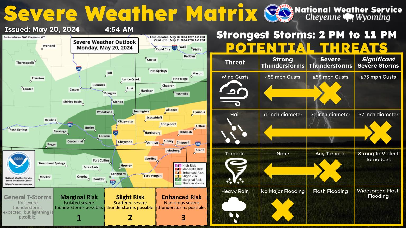
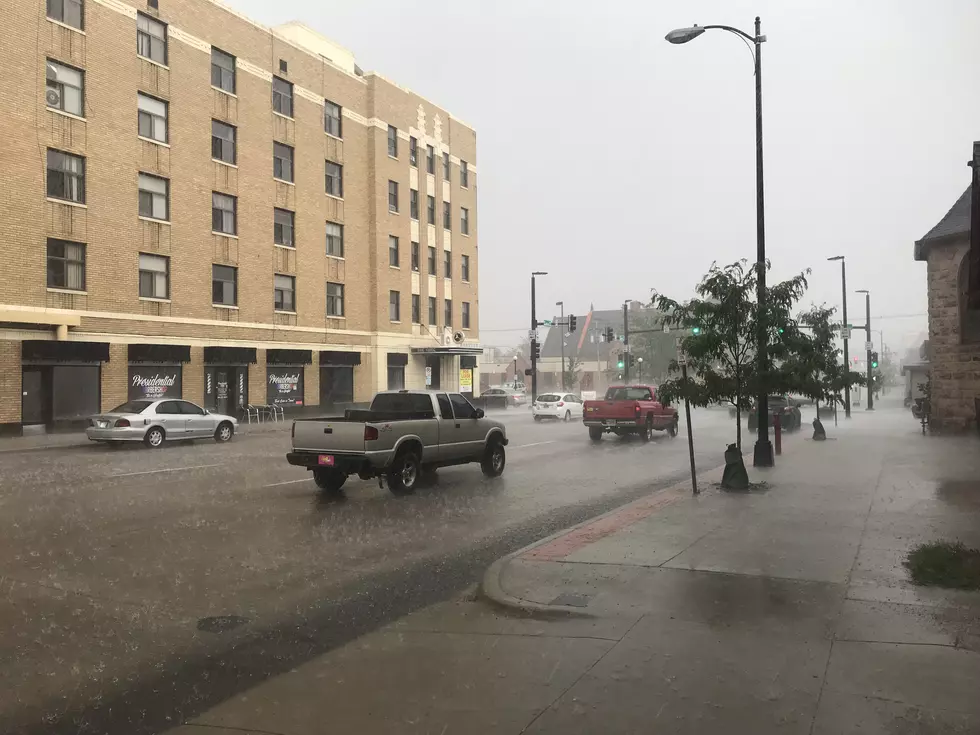
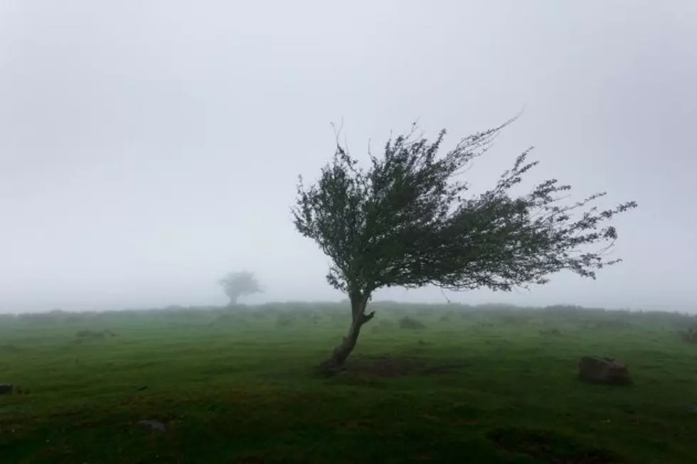
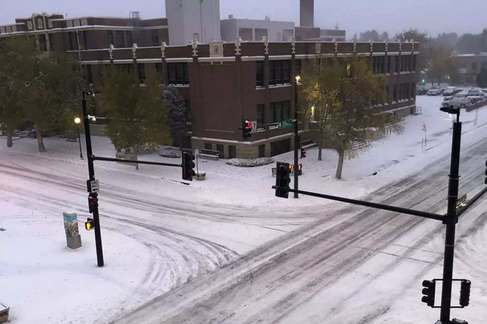
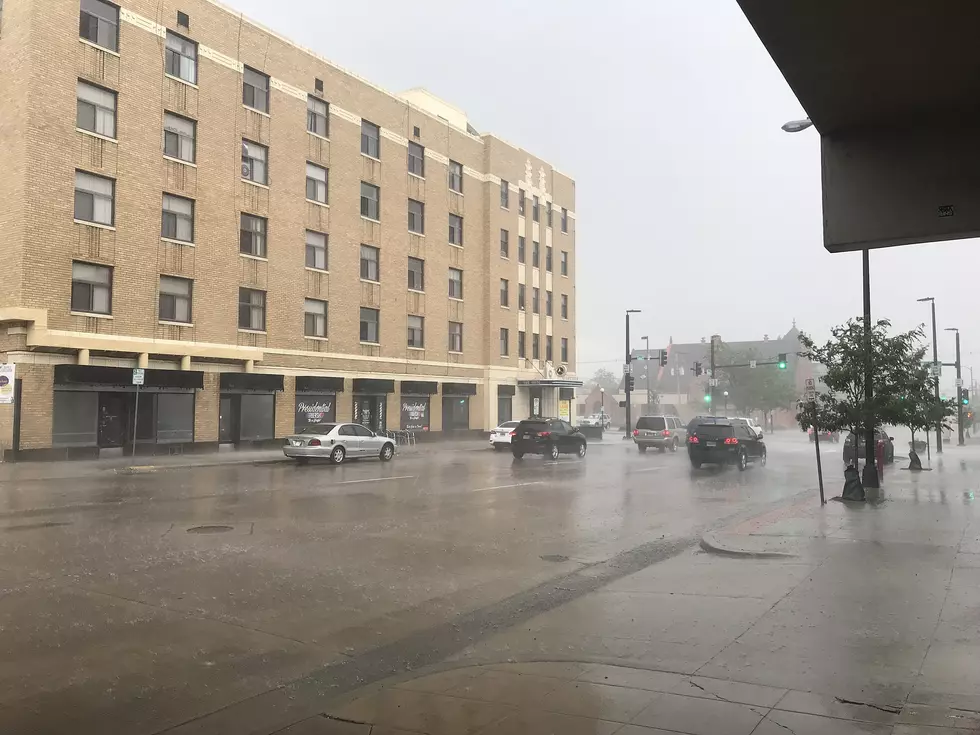
Southeast Wyoming can expect rain through the weekend with heavy snow at higher elevations, according to the Cheyenne Office of the National Weather Service.

The agency posted the following on its website:

The weekend forecast for southeast Wyoming and Nebraska Panhandle calls for unsettled weather to continue. The next in the series of low pressure systems track across Colorado, bringing snow to southeast Wyoming beginning tonight. Expect snow above 7000 feet with rain below 6000 feet and a mix in between for most of Saturday. A Winter Storm Warning and Winter Weather Advisories are in effect for the mountains through 6 PM Sunday. The Nebraska Panhandle can expect rain beginning early Saturday morning and continuing through Sunday evening. We finally begin to dry out Monday morning, with warming temperatures and increasing west winds. Stay tuned!

Cheyenne and Laramie Forecasts

Cheyenne Forecast:

oday
Rain and snow showers, becoming all rain after 5pm. Some thunder is also possible. Temperature falling to around 37 by 1pm. Breezy, with a north northeast wind 15 to 20 mph. Chance of precipitation is 100%. Little or no snow accumulation expected.
Tonight
Rain showers likely before 7pm, then rain and snow showers likely. Cloudy, with a low around 32. North wind 10 to 15 mph. Chance of precipitation is 60%. Little or no snow accumulation expected.
Sunday
A chance of rain and snow showers before 11am, then a chance of rain showers. Some thunder is also possible. Partly sunny, with a high near 54. North northwest wind 10 to 15 mph. Chance of precipitation is 30%.
Sunday Night
A slight chance of showers and thunderstorms before 9pm, then a slight chance of showers between 9pm and midnight. Partly cloudy, with a low around 34. West wind 5 to 15 mph. Chance of precipitation is 20%.
Monday
Mostly sunny, with a high near 64. Breezy, with a west wind 15 to 20 mph.
Monday Night
A 20 percent chance of showers after midnight. Partly cloudy, with a low around 39. Breezy.
Tuesday
A slight chance of showers between noon and 3pm, then a slight chance of showers and thunderstorms after 3pm. Sunny, with a high near 63. Windy. Chance of precipitation is 20%.
Tuesday Night
A chance of showers. Partly cloudy, with a low around 37. Breezy.
Wednesday
A slight chance of showers, then a chance of showers and thunderstorms after noon. Mostly sunny, with a high near 56. Breezy.
Wednesday Night
A chance of rain showers before midnight, then a chance of rain and snow showers. Some thunder is also possible. Mostly cloudy, with a low around 31.
Thursday
A chance of rain and snow showers. Some thunder is also possible. Partly sunny, with a high near 49. Breezy.
Thursday Night
A chance of rain and snow showers. Mostly cloudy, with a low around 28.
Friday
A slight chance of rain and snow showers. Some thunder is also possible. Mostly sunny, with a high near 54. Breezy.
Laramie Forecast
Today
Rain and snow showers, becoming all snow after 4pm. High near 41. Breezy, with an east northeast wind 15 to 20 mph, with gusts as high as 30 mph. Chance of precipitation is 100%. Little or no snow accumulation expected.
Tonight
A chance of rain and snow showers before 7pm, then a chance of snow showers. Mostly cloudy, with a low around 29. North northeast wind 5 to 15 mph. Chance of precipitation is 40%.
Sunday
A chance of snow showers before 10am, then a chance of rain and snow showers between 10am and 4pm, then a chance of rain showers after 4pm. Some thunder is also possible. Partly sunny, with a high near 52. Breezy, with a west northwest wind 5 to 10 mph increasing to 15 to 20 mph in the afternoon. Winds could gust as high as 30 mph. Chance of precipitation is 40%.
Sunday Night
A slight chance of rain and snow showers before midnight, then a chance of sprinkles and flurries between midnight and 2am, then a chance of flurries after 2am. Some thunder is also possible. Partly cloudy, with a low around 31. West wind 10 to 15 mph. Chance of precipitation is 20%.
Monday
Mostly sunny, with a high near 59. Breezy, with a west wind 10 to 15 mph increasing to 20 to 25 mph in the afternoon. Winds could gust as high as 35 mph.
Monday Night
A chance of rain showers before 3am, then a chance of rain and snow showers between 3am and 5am, then a chance of snow showers after 5am. Mostly cloudy, with a low around 31. Breezy. Chance of precipitation is 40%.
Tuesday
A slight chance of rain and snow showers between noon and 1pm, then a slight chance of rain showers after 1pm. Some thunder is also possible. Sunny, with a high near 58. Windy. Chance of precipitation is 20%.
Tuesday Night
A chance of rain showers before 2am, then a chance of rain and snow showers. Partly cloudy, with a low around 32. Breezy.
Wednesday
A chance of rain and snow showers before 7am, then a chance of snow showers between 7am and 10am, then a chance of rain showers after 10am. Some thunder is also possible. Partly sunny, with a high near 52. Breezy.
Wednesday Night
A chance of rain showers before 8pm, then a chance of rain and snow showers between 8pm and 10pm, then a chance of snow showers after 10pm. Mostly cloudy, with a low around 28.
Thursday
A chance of rain and snow showers. Some thunder is also possible. Partly sunny, with a high near 48.
Thursday Night
A slight chance of rain and snow showers. Mostly cloudy, with a low around 23.
Friday
A slight chance of rain and snow showers. Mostly sunny, with a high near 52. Breezy.

Check Out the Damages from Cheyenne's Wild Spring Wind Storm

On April 6 and 7, 2024, wild winds exceeding 90 mph blew through SE Wyoming, causing havoc in Cheyenne and on the interstate. Everything from fences to semis were upturned in the wind storm. Check out the damage shared by residents below.

Gallery Credit: Doug Randall

More From KGAB