

Rain And Snow Possible In SE Wyoming Tonight And Monday
Southeast Wyoming can expect rain and/or snow this evening and into Monday.
After that, partly cloudy skies and mild conditions will hold sway for most of the workweek, according to the Cheyenne Office of the National Weather Service.
The agency posted the following on its website: :A fairly average week is expected across the region. Temperatures warm into the 50s and 60s each day. Rain chances start off the work week then the remaining we will see primarily partly cloudy skies."
Cheyenne, Laramie Forecasts
Cheyenne Forecast
This Afternoon
Mostly sunny, with a high near 47. East southeast wind around 10 mph.
Tonight
Showers and thunderstorms before 3am, then showers likely. Low around 35. East wind 5 to 10 mph becoming north northwest after midnight. Chance of precipitation is 80%. New rainfall amounts between a quarter and half of an inch possible.
Monday
A chance of rain showers, possibly mixing with snow after 8am, then gradually ending. Cloudy through mid morning, then gradual clearing, with a high near 51. North northwest wind around 5 mph becoming south in the afternoon. Chance of precipitation is 40%.
Monday Night
Partly cloudy, with a low around 32. South wind 5 to 10 mph.
Tuesday
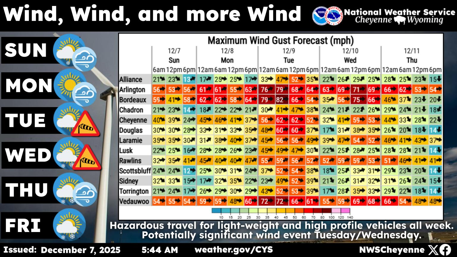
Sunny, with a high near 60. West wind 10 to 15 mph, with gusts as high as 25 mph.
Tuesday Night
Mostly clear, with a low around 36.
Wednesday
Mostly sunny, with a high near 61.
Wednesday Night
Mostly clear, with a low around 34.
Thursday
Mostly sunny, with a high near 62.
Thursday Night
Mostly cloudy, with a low around 36.
Friday
Partly sunny, with a high near 64.
Friday Night
A slight chance of showers. Mostly cloudy, with a low around 37.
Saturday
A slight chance of showers. Mostly sunny, with a high near 58.
Laramie Forecast
This Afternoon
A 20 percent chance of showers after 4pm. Mostly sunny, with a high near 51. East wind 10 to 15 mph.
Tonight
Rain showers likely before 5am, then a chance of rain and snow showers. Cloudy, with a low around 34. East wind 5 to 10 mph becoming south southwest after midnight. Chance of precipitation is 70%. Little or no snow accumulation expected.
Monday
A chance of rain and snow showers before 7am, then a slight chance of rain showers between 7am and 8am. Mostly cloudy, then gradually becoming sunny, with a high near 52. West wind around 5 mph. Chance of precipitation is 30%.
Monday Night
Mostly clear, with a low around 33. South wind 5 to 10 mph.
Tuesday
Sunny, with a high near 55. Breezy, with a west southwest wind 15 to 20 mph increasing to 20 to 25 mph in the afternoon. Winds could gust as high as 40 mph.
Tuesday Night
Mostly clear, with a low around 33. Breezy.
Wednesday
Sunny, with a high near 59. Breezy.
Wednesday Night
Mostly clear, with a low around 32.
Thursday
Mostly sunny, with a high near 60.
Thursday Night
Mostly cloudy, with a low around 35.
Friday
Partly sunny, with a high near 60.
Friday Night
A slight chance of showers. Mostly cloudy, with a low around 35.
Saturday
A slight chance of showers. Mostly sunny, with a high near 56.
The Week That Was: In Photos (Oct. 22, 2026)
More From KGAB