Southeast Wyoming Travel Woes to Continue as Winds Pick Up Tonight
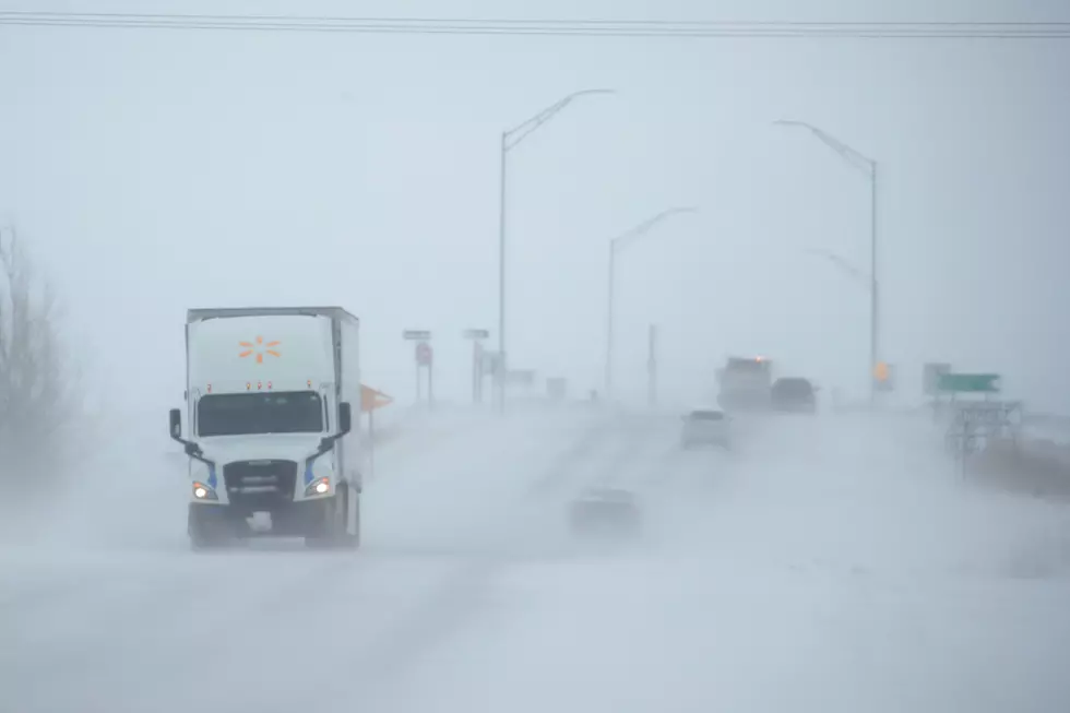
Strong winds combined with last night's and today's snow could make for difficult travel in southeast Wyoming tonight into Thursday morning, the National Weather Service in Cheyenne says.
A High Wind Watch is in effect from 11 a.m. tonight through Thursday morning, which includes Elk Mountain and Arlington, the I-80 Summit and foothills, and Bordeaux.
URGENT - WEATHER MESSAGE
National Weather Service Cheyenne WY
110 PM MST Wed Jan 18 2023

WYZ106-110-116-117-190000-
/O.CON.KCYS.HW.A.0006.230119T0600Z-230119T1800Z/
Central Laramie Range and Southwest Platte County-
North Snowy Range Foothills-South Laramie Range-
South Laramie Range Foothills-
Including the cities of Bordeaux, Arlington, Elk Mountain,
Buford, Pumpkin Vine, Vedauwoo, Whitaker, Federal,
and Horse Creek
110 PM MST Wed Jan 18 2023

...HIGH WIND WATCH REMAINS IN EFFECT FROM 11 PM MST THIS EVENING
THROUGH THURSDAY MORNING...

* WHAT...West winds 25 to 35 mph with gusts up to 60 mph
  possible.

* WHERE...Central Laramie Range and Southwest Platte County,
  North Snowy Range Foothills, South Laramie Range and South
  Laramie Range Foothills.

* WHEN...From 11 PM MST this evening through Thursday morning.

* IMPACTS...Damaging winds could blow down trees and power
  lines. Widespread power outages are possible. Travel could be
  difficult, especially for high profile vehicles.

* ADDITIONAL DETAILS...Blowing and drifting snow may be possible
  which could lead to poor visibility and difficult travel.

PRECAUTIONARY/PREPAREDNESS ACTIONS...

Monitor the latest forecasts and warnings for updates on this
situation. Fasten loose objects or shelter objects in a safe
location prior to the onset of winds.
TIPS: Here's how you can prepare for power outages

"Sustained west winds of 30 to 45 MPH with gusts around 60 MPH are expected," the NWS said.
"Travelers should also be aware of the possibility for blowing and drifting snow along Interstate 25 and Interstate 80," the NWS added.
As of 2:36 p.m., eastbound I-80 from exit 370 (Archer) to the Nebraska state line was still closed due to winter conditions, and a no unnecessary travel advisory was in effect between exit 29 (Whitaker Road) and exit 73 (Wyoming 34) on I-25.
Be sure to dial 511 or check wyoroad.info for the latest road conditions and closure information prior to heading out.
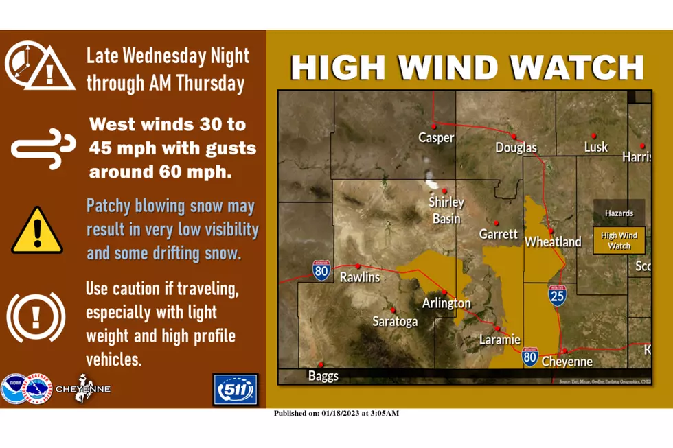
January 18th: High Wind Watches are in effect for Arlington and Elk Mountain, Interstate 80 Summit and Foothills, and Bordeaux late Wednesday night through Thursday morning. Sustained west winds of 30 to 45 MPH with gusts around 60 MPH are expected. Travelers should also be aware of the possibility for blowing and drifting snow along Interstate 25 and Interstate 80 due to the strong winds and surface snow pack from Tuesday's storm. For the latest forecast, go to weather.gov/cys.
WYDOT Urges 'Don't Crowd the Plow!' After 105 Plows Hit in 5 Years
Gallery Credit: Joy Greenwald
Here's What Wyomingites REALLY Think About The Wind
More From KGAB


